Results for: Atmosphere
2011 Hurricane Season and NASA Research: An Interview with Scott Braun
August 1, 2011With the 2011 Atlantic hurricane season approaching its peak, a NASA meteorologist explores the key questions in hurricane research. Read more
The Carbon Cycle
June 16, 2011Carbon flows between the atmosphere, land, and ocean in a cycle that encompasses nearly all life and sets the thermostat for Earth's climate. By burning fossil fuels, people are changing the carbon cycle with far-reaching consequences. Read more
Earth Matters Blog
June 14, 2011Earth is an amazing planet, and the one that matters most to us. Let's have a conversation about it. Read more
Heavy Rains and Dry Lands Don't Mix: Reflections on the 2010 Pakistan Flood
April 6, 2011Unusual atmospheric conditions brought exceptional rain to Pakistan in the summer of 2010, causing the country's worst flooding in modern history. Read more
Aerosols: Tiny Particles, Big Impact
November 2, 2010Tiny aerosol particles can be found over oceans, deserts, mountains, forests, ice sheets, and every ecosystem in between. They drift in the air from the stratosphere to the surface. Despite their small size, they have major impacts on our climate and our health. Read more
The Water Cycle
October 1, 2010Landscape sculptor. Climate driver. Life supporter. Water is the most important molecule on our planet. Read more
Notes from the Field Blog - Urban Aerosols: Who CARES?
June 9, 2010Join us as NASA scientists aboard a B-200 aircraft cruise over California sampling urban pollution and other aerosols during the Carbonaceous Aerosol and Radiative Effects Study (CARES). Read more
Global Warming
June 3, 2010Global warming is happening now, and scientists are confident that greenhouse gases are responsible. To understand what this means for humanity, it is necessary to understand what global warming is, how scientists know it's happening, and how they predict future climate. Read more
Climate Q&A
March 9, 2010From why global warming is a problem to whether increased solar activity could be behind it, this Q&A includes responses to common questions about climate change and global warming. Read more
World of Change: Severe Storms
August 27, 2009This collection of images featuring the strongest hurricane, cyclone, or typhoon from any ocean during each year of the past decade includes storms both famous—or infamous—and obscure. Read more
Earth Perspectives
November 24, 2008In 2008, as NASA celebrated its 50th anniversary, the Earth Observatory asked a number of Earth scientists what we have learned about our home planet by going into space. Read more
American Carbon: Vulcan Project Maps Nation's Fossil Fuel Emissions in Detail
July 9, 2008The Vulcan Project maps when and where Americans burn fossil fuels. Read more
Cities at Night: The View from Space
April 22, 2008Astronauts onboard the International Space Station capture nighttime photographs of city lights, spectacular evidence of humanity's existence, our distribution, and our ability to change our environment. Read more
Science Blog - Expedition to Siberia
July 29, 2007As Earth's average temperature rises, and most rapidly in the high latitudes, what is happening to the great northern forests of Siberia? Join scientists from NASA and Russia's Academy of Science on an expedition down the Kochechum River in north-central Siberia as they go in search of answers. Read more
The Amazon's Seasonal Secret
May 31, 2007Satellite data detect previously unknown seasonal cycles in the leaf area of the Amazon Rainforest. Increasing leaf area during the sunny dry season may actually trigger the seasonal rains. Read more
Arctic Reflection: Clouds Replace Snow and Ice as Solar Reflector
January 31, 2007Using satellite observations of sea ice and clouds, scientists discover that Earth’s poles are still effective reflectors for incoming sunlight. Read more
Urban Rain
December 11, 2006Most city dwellers worry about what the weather will do to their city, but for meteorologist Marshall Shepherd, the real question is what are cities doing to the weather. Read more
Paleoclimatology: Understanding the Past to Predict the Future
November 14, 2006Scientists use complicated climate models to predict how Earth's climate might change in the future. One of the best ways to test the reliability of such models is to see how well they recreate climates of the past. Read more
Hurricanes: The Greatest Storms on Earth
November 1, 2006Few things in nature can compare to the destructive force of a hurricane. Called the greatest storm on Earth, a hurricane is capable of annihilating coastal areas with sustained winds of 155 mph or higher and intense areas of rainfall and a storm surge. In fact, during its life cycle a hurricane can expend as much energy as 10,000 nuclear bombs! Read more
Tracking Nature's Contribution to Pollution
October 17, 2006Scientists combined models and satellite data to track the spread of pollutants from forest fires in Alaska and Canada in 2004. They discovered that fires can have a significant impact on air pollution far from the fires location. Read more
Cloudy with a Chance of Drizzle
August 9, 2005By analyzing data from the MISR instrument, scientists discover that a unique type of cloud formation is much more prevalent than previously believed. Read more
Nimbus' 40th Anniversary
July 19, 2005On August 28, 2004, NASA celebrated the 40th anniversary of the launch of the Nimbus-1 Earth-observation satellite. Starting in 1964 and for the next twenty years, the Nimbus series of missions was the United States' primary research and development platform for satellite remote-sensing of the Earth. Read more
Deep Freeze and Sea Breeze: Changing Land and Weather in Florida
May 18, 2005A regional climate model and NASA satellite data say land cover change in south Florida has created both hotter, drier summers, and more severe freezes in the winter. Read more
Paleoclimatology: The Oxygen Balance
May 6, 2005Oxygen is one of the most significant keys to deciphering past climates. Read more
Terra Turns Five
March 1, 2005In February 2000, NASA's Terra satellite began measuring Earth's vital signs with a combination of accuracy, precision, and resolution the world had never before seen. While the mission is still in the process of fulfilling its main science objectives, Terra's portfolio of achievements to date already marks the mission a resounding success. Read more
Polar Wind Data Blow New Life Into Forecasts
January 11, 2005Where real-world weather observations are scarce, scientists are estimating winds by tracking the movement of clouds and water vapor between consecutive Terra and Aqua satellite images. In a new Earthsky podcast, atmospheric scientist Jeff Key talks about how the technique has improved forecasts and what will happen when these NASA missions reach their end. Read more
Aura: A Mission Dedicated to the Health of Earth's Atmosphere
December 7, 2004On July 15, 2004 at 3:02 a.m., NASA launched the Aura satellite, the third flagship in a series of Earth-observing satellites designed to view Earth as a whole system, observe the net results of complex interactions within the climate system, and understand how the planet is changing in response to natural and human influences. Read more
A New IDEA in Air Quality Monitoring
August 17, 2004NASA satellite data of regional haze allow EPA scientists to expand their focus from local to regional air quality monitoring and forecasting. Read more
Clouds are Cooler than Smoke
July 27, 2004New NASA research shows that smoke from fires in the Amazon Basin inhibits clouds and exerts a warming influence on Earth's surface. Read more
Joanne Simpson
April 28, 2004Joanne Simpson became the first woman Ph.D. meteorologist. She also pioneered studies of cloud models, hurricanes, weather modification, and guided the development of the Tropical Rainfall Measuring Mission. Read more
Will Runaway Water Warm the World?
March 15, 2004As the Earth heats up more water will make its way into the atmosphere, trapping even heat near the surface. To predict how much temperatures could rise in the future, scientists are working to understand how much water could enter the atmosphere and how that might contribute to climate change. Read more
Tango in the Atmosphere: Ozone and Climate Change
February 24, 2004Over recent decades the stratosphere has cooled while stratospheric ozone has decreased. Low temperatures could be causing further ozone depletion, which may delay recovery of the ozone layer. Read more
Smoke's Surprising Secret
January 7, 2004A high school student in Texas working on a back yard science project made a surprising discovery in the spring of 2002. Intending to detect the presence of fungal spores and bacteria in globe-trotting dust, Sarah Mims instead discovered that fungal spores had hitched a ride across the Gulf of Mexico with smoke from fires in Central America. This young, amateur scientist's discovery could change the prevailing wisdom on the benefits of burning diseased crops or timber. Read more
Results for: Heat
Where Is the Hottest Place on Earth?
April 5, 2012Satellite research shows that the world’s hottest spot changes, though the conditions don’t. Think dry, rocky, and dark-colored lands...and cities. Read more
Earth Matters Blog
June 14, 2011Earth is an amazing planet, and the one that matters most to us. Let's have a conversation about it. Read more
Global Warming
June 3, 2010Global warming is happening now, and scientists are confident that greenhouse gases are responsible. To understand what this means for humanity, it is necessary to understand what global warming is, how scientists know it's happening, and how they predict future climate. Read more
Climate Q&A
March 9, 2010From why global warming is a problem to whether increased solar activity could be behind it, this Q&A includes responses to common questions about climate change and global warming. Read more
The World We Avoided by Protecting the Ozone Layer
May 14, 2009An international team of scientists used a state-of-the-art computer model to learn “what might have been” if ozone-destroying chemicals had not been banned through the 1989 Montreal Protocol. Read more
Climate and Earth’s Energy Budget
January 14, 2009Earth’s temperature depends on how much sunlight the land, oceans, and atmosphere absorb, and how much heat the planet radiates back to space. This fact sheet describes the net flow of energy through different parts of the Earth system, and explains how the planetary energy budget stays in balance. Read more
Correcting Ocean Cooling
November 5, 2008Scientists revise their conclusion that the ocean has cooled since 2003. Read more
Earth's Temperature Tracker
November 5, 2007NASA scientist James Hansen has tracked Earth's temperature for decades, and he is confident the global warming trend of 0.9 degrees Celsius observed since 1880 is mainly the result of human-produced greenhouse gases. Read more
Science Blog - Expedition to Siberia
July 29, 2007As Earth's average temperature rises, and most rapidly in the high latitudes, what is happening to the great northern forests of Siberia? Join scientists from NASA and Russia's Academy of Science on an expedition down the Kochechum River in north-central Siberia as they go in search of answers. Read more
Beating the Heat in the World's Big Cities
August 2, 2006Green roofs can mitigate urban heat islands and heat waves. Read more
Ask-A-Scientist
July 25, 2006Questions from visitors to the Earth Observatory and answers from scientists. Read more
Earth's Big Heat Bucket
April 24, 2006The Earth now absorbs more energy than it emits back into space, and the excess heat is hiding in the ocean. Read more
Will Runaway Water Warm the World?
March 15, 2004As the Earth heats up more water will make its way into the atmosphere, trapping even heat near the surface. To predict how much temperatures could rise in the future, scientists are working to understand how much water could enter the atmosphere and how that might contribute to climate change. Read more
Aurora Dancing in the Night
January 5, 2004Astronaut Don Pettit describes the aurora he photographed while aboard the International Space Station. Read more
Dwindling Arctic Ice
November 19, 2003Since the 1970s, Arctic sea ice has been melting at the rate of 9 percent per decade. NASA researcher Josefino Comiso points to an accelerating warming trend as a primary cause and discusses how global climate change may be influencing the shrinking Arctic ice cap. Read more
Under a Variable Sun
August 4, 2003In their continued effort to understand the Sun, solar physicists of the 21st century have used satellite data to study how much energy reaches the outskirts of the Earth’s atmosphere and whether or how much that amount varies over time. Recently published research claims that the amount of solar energy reaching the Earth has increased over the past two solar cycles, while other scientists doubt that any such change has occurred. This story describes how gaps in the set of observations and uncertainty about the accuracy of different satellite sensors have made splicing together a complete data set so controversial. Read more
A Delicate Balance: Signs of Change in the Tropics
June 19, 2003While NASA climate scientists were reviewing radiation data emanating from the tropics simply to test existing notions, they uncovered a phenomenon no one expected. They found that progressively more thermal radiation has been escaping the atmosphere above the tropics and progressively less sunlight has been reflecting off of the clouds. Read more
Solar Radiation and Climate Experiment (SORCE) Fact Sheet
January 21, 2003Earth scientists will move a step closer to a full understanding of the Sun's energy output with the launch of the Solar Radiation and Climate Experiment (SORCE) satellite. SORCE will be equipped with four instruments now being built at the University of Colorado that will measure variations in solar radiation much more accurately than anything now in use and observe some of the spectral properties of solar radiation for the first time. With data from NASA's SORCE mission, researchers should be able to follow how the Sun affects our climate now and in the future. (Original 2001-11-30; updated 2003-01-21) Read more
Does the Earth Have an Iris Analog
June 17, 2002Much like the iris in a human eye contracts to allow less light to pass through the pupil in a brightly lit environment, Lindzen suggests that the area covered by high cirrus clouds contracts to allow more heat to escape into outer space from a very warm environment. Read more
Arbiters of Energy
June 12, 2002Clouds play a crucial role in regulating the balance of energy received by and emitted from the Earth, but scientists aren?t sure exactly what this role is. Read more
Power to the People
October 5, 2001Thanks to a team at NASA's Langley Research Center (LaRC), engineers and amateur inventors worldwide now have free access to global-scale data on natural renewable energy resources. Private companies are using these data to design, build, and market new technologies for harnessing this energy. The best part is many of these new systems will be marketed at affordable prices in underdeveloped countries for those who need them most. Read more
A Violent Sun Affects the Earth's Ozone
August 3, 2001A new study confirms a long-held theory that large solar storms rain electrically charged particles down on Earth's atmosphere and deplete the upper-level ozone for weeks to months thereafter. New evidence from NASA and NOAA satellites is helping scientists better understand how man and nature both play a role in ozone loss. Read more
Watching the Sun
June 30, 2000The Active Cavity Radiometer Irradiance Monitor III will monitor the sun's total radiation output so scientists can better predict the sun's effect on global climate change. Read more
Carbon Conundrum
May 22, 2000Paradoxically, an increase in global temperature may both increase and decrease atmospheric carbon dioxide. The key is timing. Read more
On a Clear Day
April 12, 2000Researchers clarified the issues encountered in modeling clear-sky shortwave radiation by assembling a long-term data set of cloud-free days to test the models. Read more
Blanket of Clouds
March 27, 2000Recent studies indicate that clouds absorb significantly more shortwave radiation than previously thought. Read more
Sunspots and the Solar Max
February 22, 2000This fact sheet describes solar phenomenon such as sunspots and the solar wind. Read more
Eye on the Sun - Solstice
February 7, 2000SOLSTICE, an instrument aboard the UARS satellite, created a standard against which future monitoring of the Sun could be measured. Read more
ACRIMSAT
December 21, 1999By measuring the total amount of energy that the sun delivers to the Earth with ACRIMSAT, scientists will be able to build better scientific models of the Earth’s climate system, providing a vital piece of the global climate change puzzle. Read more
Clouds & Radiation Fact Sheet
March 1, 1999The study of clouds, where they occur, and their characteristics, plays a key role in the understanding of climate change. Low, thick clouds reflect solar radiation and cool the Earth's surface. High, thin clouds transmit incoming solar radiation and also trap some of the outgoing infrared radiation emitted by the Earth, warming the surface. Read more
Results for: Land
Landsat Looks and Sees
July 23, 2012The world’s longest-running Earth-observing satellite program has collected more than three million images, showing two generations of planetary evolution and of human imprints on Earth. The Landsat archives tell an unparalleled story of our land surfaces. Read more
Notes from the Field Blog: Siberia 2012 - Embenchime River Expedition
July 11, 2012A dedicated team of scientists has returned to the remote boreal forests of northern Siberia to study how the boreal ecosystem moderates Earth's climate by storing carbon and the implications of a warming climate on those forests. Read more
Where Is the Hottest Place on Earth?
April 5, 2012Satellite research shows that the world’s hottest spot changes, though the conditions don’t. Think dry, rocky, and dark-colored lands...and cities. Read more
Seeing Forests for the Trees and the Carbon: Mapping the World’s Forests in Three Dimensions
January 9, 2012Earth has a carbon problem, and some think trees are the answer. Would it help to plant more? To cut down fewer? Does it matter where? Scientists are working to get a better inventory of the carbon stored in trees. Read more
IceBridge: Building a Record of Earth’s Changing Ice, One Flight at a Time
November 2, 2011NASA is sending a fleet of airplanes to the ends of the Earth for the next several years to figure out how and why polar ice is changing. Read more
Notes from the Field Blog: Eco3D: Exploring the Third Dimension of Forest Carbon
August 25, 2011From August through September, NASA's P-3 research aircraft will be flying from Quebec to Florida to measure the three-dimensional structure and carbon storage capacity of North American forests. Read more
The Carbon Cycle
June 16, 2011Carbon flows between the atmosphere, land, and ocean in a cycle that encompasses nearly all life and sets the thermostat for Earth's climate. By burning fossil fuels, people are changing the carbon cycle with far-reaching consequences. Read more
Heavy Rains and Dry Lands Don't Mix: Reflections on the 2010 Pakistan Flood
April 6, 2011Unusual atmospheric conditions brought exceptional rain to Pakistan in the summer of 2010, causing the country's worst flooding in modern history. Read more
We Can See Clearly Now: ISS Window Observational Research Facility
March 4, 2011New optical gear on the International Space Station is giving students and earth scientists a better view of our world. Read more
Earth Observing-1: Ten Years of Innovation
November 22, 2010Scheduled to fly for a year, designed to last a year and a half, EO-1 celebrated its tenth anniversary on November 21, 2010. During its decade in space, the satellite has accomplished far more than anyone dreamed. Read more
World of Change: Seasons of Lake Tahoe
October 20, 2010Perhaps the most familiar change in our changing world is the annual swing of the seasons. This series of images shows the effects of the seasons on the Lake Tahoe region between 2009 and 2010. Read more
The Water Cycle
October 1, 2010Landscape sculptor. Climate driver. Life supporter. Water is the most important molecule on our planet. Read more
Dalia Kirschbaum Talks About Making a Global Landslide Inventory
July 6, 2010NASA scientist Dalia Kirschbaum talks about the potential for a global inventory of rain-triggered landslides to help scientists better understand when and where landslides are most likely to occur. Read more
Frozen Ground: An Interview with Permafrost Expert Larry Hinzman
June 10, 2010NASA interviews Larry Hinzman, director of the International Arctic Research Center at the University of Alaska, about greenhouse gases trapped beneath the Arctic permafrost. Read more
Global Warming
June 3, 2010Global warming is happening now, and scientists are confident that greenhouse gases are responsible. To understand what this means for humanity, it is necessary to understand what global warming is, how scientists know it's happening, and how they predict future climate. Read more
World of Change: Devastation and Recovery at Mt. St. Helens
May 17, 2010The devastation of the May 1980 eruption of Mt. St. Helens and the gradual recovery of the surrounding landscape is documented in this series of satellite images from 1979—2011. Read more
World of Change: Yellow River Delta
January 26, 2010Once free to wander up and down the coast of the North China Plain, the Yellow River Delta has been shaped by levees, canals, and jetties in recent decades. Read more
Water Watchers
January 21, 2010In Idaho, NASA’s Landsat satellites are helping officials manage water resources and settle conflicts. Read more
NASA's Newest Map of the World
November 18, 2009Why did it take nearly three decades for scientists to create the first global portraits of Earth from NASA's Landsat missions? Read more
World of Change: Severe Storms
August 27, 2009This collection of images featuring the strongest hurricane, cyclone, or typhoon from any ocean during each year of the past decade includes storms both famous—or infamous—and obscure. Read more
Planetary Motion: The History of an Idea That Launched the Scientific Revolution
July 7, 2009Attempts of Renaissance astronomers to explain the puzzling path of planets across the night sky led to modern science’s understanding of gravity and motion. Read more
World of Change: Burn Recovery in Yellowstone
June 30, 2009In 1988, wildfires raced through Yellowstone National Park, consuming hundreds of thousands of acres. This series of Landsat images tracks the landscape’s slow recovery through 2011. Read more
World of Change: Shrinking Aral Sea
May 19, 2009A massive irrigation project in the Kyzylkum Desert of central Asia has devastated the Aral Sea over the past 50 years. These images show the continued decline of the Southern Aral Sea in the past decade, as well as the first steps of recovery in the Northern Aral Sea in recent years. Read more
Earth Perspectives
November 24, 2008In 2008, as NASA celebrated its 50th anniversary, the Earth Observatory asked a number of Earth scientists what we have learned about our home planet by going into space. Read more
When the Earth Moved Kashmir
October 22, 2008Science and relief efforts come together in the aftermath of the Kashmir Earthquake. Read more
Devastating Drought Settles on the High Plains
August 11, 2008A drought to rival the Dust Bowl settled over the southern Great Plains in summer 2008. Read more
Siberia Blog 2008
July 16, 2008Scientists on a remote river in Siberia send field reports of their expedition to study the impacts of fire and climate change on northern forests and tundra. Read more
Cities at Night: The View from Space
April 22, 2008Astronauts onboard the International Space Station capture nighttime photographs of city lights, spectacular evidence of humanity's existence, our distribution, and our ability to change our environment. Read more
Amazon Fires on the Rise
March 7, 2008In 2006, fires and smoke in the Amazon declined significantly for the first time in nearly a decade. Is Amazon burning under control? Read more
Ancient Forest to Modern City
February 1, 2008To understand how local weather shifted when the towering forests of the eastern United States gave way to fields and cities, scientists must reconstruct the region's historical landscapes. Read more
Coal Controversy In Appalachia
December 21, 2007In Appalachia, coal operators are removing the tops of mountains and burying hundreds of miles of streams with rock waste as they mine coal seams hundreds of feet below the mountain top. Read more
Observing Volcanoes, Satellite Thinks for Itself
December 6, 2007Satellite sensor technology automates volcanic observation, providing timely information about the eruption of Nyamuragira Volcano. Read more
Can Earth's Plants Keep up with Us?
September 26, 2007Studying human appropriation of net primary productivity helps predict the planet's ability to sustain the human population. Read more
Satellite Monitors Rains that Trigger Landslides
June 8, 2007Researchers are developing a landslide early-warning system that uses space-based measurements of rainfall combined with a global risk map based on terrain, landcover, and soils. Read more
Something Under the Ice is Moving
April 23, 2007Satellites measurements of ice sheet elevation reveal a complex network of subglacial lakes in Antarctica. As water flows from lake to lake, the ice sheet above them rises and falls. Read more
Tropical Deforestation
March 30, 2007Tropical forests are home to half the Earth's species, and their trees are an immense standing reservoir of carbon. Deforestation will have increasingly serious consequences for biodiversity, humans, and climate. Read more
Fire Alarms from Orbit
February 23, 2007NASA satellites are playing a key role in an alert system that notifies the South African electric company when potential outage-causing fires come near the power lines. Read more
Remote River Reconnaissance
February 9, 2007Elevation data collected from the space shuttle help map Earth's rivers in remote regions. Read more
Defining Desertification
January 3, 2007A string of dry years shriveled vegetation in Africa's Sahel, causing some to fear that the Sahara Desert was shifting south. Satellite data spanning more than twenty years now shows that the Sahel is holding its own against the Sahara and may be recovering with the return of near-normal rainfall. Read more
Rise and Fall: Satellites Reveal Full Length of Tsunami-Generating Earthquake
September 28, 2006Ambiguous seismic data and a spotty GPS network initially frustrated geologists mapping the length of the tsunami-generating earthquake that struck Indonesia in 2004. Caltech grad student Aron Meltzner decided to improvise: he mapped the rupture using satellite images of coral reefs and coastlines that rose or sank during the quake. Read more
Beating the Heat in the World's Big Cities
August 2, 2006Green roofs can mitigate urban heat islands and heat waves. Read more
Defying Dry: Amazon Greener in Dry Season than Wet
July 5, 2006Satellites reveal that the Amazon rainforest is greener during the dry season than during the wet season. Read more
Paleoclimatology: Explaining the Evidence
May 9, 2006Scientists' efforts to explain the paleoclimate evidence-not just the when and where of climate change, but the how and why-have produced some of the most significant theories of how the Earth's climate system works. Read more
Forest on the Threshold
April 18, 2006NASA data reveal that Arctic forests are getting browner as temperatures rise. The downward trend in the forests' health may be a sign that global warming is impacting the forests sooner than scientists predicted. Read more
Lake Victoria's Falling Waters
March 15, 2006By early 2006, the Jason-1 satellite showed that water levels on Africa's Lake Victoria had dropped to levels not seen in decades, leaving the millions who depend on the lake high and dry. Read more
Aiding Afghanistan
February 7, 2006NASA satellite data help optimize agricultural output in Afghanistan. Read more
Paleoclimatology: Climate Close-up
December 23, 2005Both tree rings and similar rings in ocean coral can tell scientists about rainfall and temperatures during a single growing season. Read more
Mosaic of Antarctica
December 6, 2005Researchers use MODIS images to show Antarctica like you've never seen it before. Read more
Looking for Lawns
November 8, 2005Move over, corn. According to a satellite-based estimate, lawns constitute the largest area of irrigated crops in America. Read more
The Art of Science
October 18, 2005Astronauts onboard the International Space Station (ISS) have many tasks, but a consistent favorite is taking photographs of Earth. Read more
Fire Emergency in Acre, Brazil
October 11, 2005NASA-funded ecologists studying the Amazon Rainforest use satellite data to help fight out-of-control fires in Acre, Brazil. Read more
Operation Antarctica
September 15, 2005When Program Managers of the U.S. Antarctic Program had to figure out how to get supplies to research camps in Antarctica, they turned to NASA sensors for information. Read more
Out of the Crevasse Field
August 30, 2005NASA satellite data help the Antarctic Traverse Team avoid danger and beat a path to the South Pole. Read more
Time on the Shelf
July 12, 2005Twenty-five years of NASA scientists' research in Antarctica and Greenland show that even huge ice sheets can change more quickly than scientists thought, causing sea level to rise. Read more
Paleoclimatology
July 10, 2005Like detectives reconstructing a crime scene, paleoclimatologists scour the Earth for clues to understand the climates of the past and to learn how and why climate changes. Read more
Paleoclimatology: Speleothems
June 28, 2005Like detectives reconstructing a crime scene, paleoclimatologists scour the Earth for clues to understand the climates of the past and to learn how and why climate changes. Read more
Deep Freeze and Sea Breeze: Changing Land and Weather in Florida
May 18, 2005A regional climate model and NASA satellite data say land cover change in south Florida has created both hotter, drier summers, and more severe freezes in the winter. Read more
High Water: Building a Global Flood Atlas
April 6, 2005For more than a decade, geologist Bob Brakenridge has been pioneering the use of satellite data for monitoring floods. Read more
Stealing Rain from the Rainforest
March 8, 2005In a rainforest, visible effects of drought can be subtle. An experiment that mimicked the impact of a severe El Nino in the Amazon revealed surprising signs of stress that could be seen from space. Read more
Terra Turns Five
March 1, 2005In February 2000, NASA's Terra satellite began measuring Earth's vital signs with a combination of accuracy, precision, and resolution the world had never before seen. While the mission is still in the process of fulfilling its main science objectives, Terra's portfolio of achievements to date already marks the mission a resounding success. Read more
Collapse of the Kolka Glacier
September 9, 2004Russian scientists mapped Mount Kazbek in the Caucasus Mountains, site of a massive glacial collapse, and used satellite data to assess the possibility of additional dangers. Read more
Mayan Mysteries
August 24, 2004Satellite data help scientists understand Mesoamerica's past and point the way toward a brighter future. Read more
Sensing Remote Volcanoes
July 13, 2004More than 1,500 potentially active volcanoes dot the Earths landscape, of which approximately 500 are active at any given time. Satellite technology now makes it possible to monitor volcanic activity in even the most isolated corners of the globe. Read more
Uncovering Chameleons
June 29, 2004Using satellite data and museum specimen records, scientists predicted the location of 7 new chameleon species in Madagascar. Read more
Sizing Up the Earth's Glaciers
June 22, 2004Visit the worlds high mountain ranges and youll probably see less ice and snow today than you would have a few decades ago. More than 110 glaciers have disappeared from Montanas Glacier National Park over the past 150 years. Read more
Flood Disaster Hits Hispaniola
June 11, 2004In late May 2004, a tragic flood disaster hit the Caribbean island of Hispaniola, claiming the lives of more than 2,000 people. Much of the town of Jimani, Dominican Republic, was overrun by mud, gravel and debris swept off the Massif de la Salle by torrential rains. Across the border in Haiti, the village of Mapou now sits at the bottom of a newly formed lake. In a rapid response initiative, researchers used NASA satellite remote sensing data to assess what caused the disaster and to map the extent of the damage. Read more
From Forest to Field: How Fire is Transforming the Amazon
June 8, 2004Current estimates of Amazon deforestation may capture less than half of the area degraded by logging and accidental fire. If the current trends continue, the entire Amazon frontier could be transformed into grass or scrubland. Read more
GRACE Fact Sheet
March 30, 2004Launched in March 2002, the Gravity Recovery and Climate Experiment is a five-year mission intended to produce maps of the Earth’s gravity field with unprecedented precision and resolution. Read more
LIDAR - In the Wake of the Storm
February 2, 2004To understand how severe storms like Hurricane Isabel shape coastal areas, NASA and USGS scientists mapped the North Carolina coastline before and after Isabel came ashore. Their maps, made with an advanced lidar system that uses light to measure elevation, will help scientists understand how a new inlet formed on Hatteras Island. Read more
Denali's Fault
November 19, 2003During the afternoon of November 3, 2002, the water in Seattle’s Lake Union suddenly began sloshing hard enough to knock houseboats off their moorings. Water in pools, ponds, and bayous as far away as Texas and Louisiana splashed for nearly half an hour. The cause? Alaska’s Denali Fault was on the move, jostling the state with a magnitude 7.9 earthquake. Read more
Watching the World Go By
October 22, 2003Space Station Science Officer Ed Lu describes what it is like to look at the Earth over the course of an orbit. His descriptions are accompanied by digital photographs of Earth he has taken and transmitted to the ground during his mission. Read more
Just Add Water: a Modern Agricultural Revolution in the Fertile Crescent
September 15, 2003Satellite observations in the Middle East's Fertile Crescent have documented a modern agricultural revolution. The dramatic changes in crop production in southern Turkey over the last decade are the result of new irrigation schemes that tap the historic Tigris and Euphrates Rivers. Read more
Land Matters
September 9, 2003Storm-related losses from the 1982-83 El Nino cost the state of California an estimated $2.2 billion. Fifteen years later, damages from the 1997-98 El Nino cost California only half that amount. Differences in storm intensity and duration accounted for some of the reduced costs, but other factors were also at work. Read more
The Great Bend of the Nile, Day and Night
July 1, 2003Photographs from the Space Shuttle reveal the densley populated communities along the banks fo the Nile River. Read more
Squeezing Water from Rock
June 24, 2003Survivors of the New Madrid earthquakes reported not only intense ground shaking and land movement, as would be expected during an earthquake, but also an unfamiliar phenomenon: water and sand spouting up through fissures, or cracks, in the Earth's surface Read more
Global Garden Gets Greener
June 5, 2003Between 1982-1999, the climate grew warmer, wetter, and sunnier in many parts of the global greenhouse. For the most part, these changes were favorable for Earth's vegetation. Satellite observations of vegetation combined with nearly 20 years of climate data reveal that productivity of Earth's land-based vegetation increased by 6 percent during the time period. The greatest increase occurred in the tropics, where decreasing cloudiness made more sunlight available. Compared to the increase in human population, however, the small increase in productivity has not changed the Earth's habitability in any significant way. Read more
Escape from the Amazon
April 23, 2003In this era of heightened concern about the relationship between the build up of atmospheric carbon dioxide and climate change, scientists are working to itemize all the ways carbon moves into and out of forest ecosystems. Perhaps nowhere on Earth do questions about the role of forests in the carbon cycle need answers more than in the Amazon Rainforest. Using satellite mapping and ground-based observations, scientists have discovered that carbon dioxide gas escaping from wetlands and flooded areas is a significant source of carbon emissions in the Amazon. Read more
How on Earth was this Image Made?
March 25, 2003Remotely sensed Earth observations can include everything from sonar measurements used to map the topography of the ocean floor to satellite-based observations of city lights. Combining observations collected by a variety of instruments at different times and places allow scientists to create an otherwise impossible view of the Earth, showing underwater mountain ranges, cloud-free skies, and city lights that are brighter than daylight. Such visualizations are invaluable for interpreting complex data and communicating scientific concepts. Read more
From Space to the Outback
March 18, 2003The 2002-03 fire season in Australia echoes the devastating 2001-02 season that climaxed in the bush on the outskirts of Sydney and drew international attention once again to the city that had hosted the 2000 Summer Olympics. In the aftermath of that season, Australian scientists and government agencies developed a new fire monitoring system that uses observations from NASA’s Moderate Resolution Imaging Spectroradiometer (MODIS) sensors on the Terra and Aqua satellites to identify fires in remote locations in Australia. The system provides a big-picture perspective of fires across the country and helps fire emergency agencies allocate resources to the areas where they are needed most. Read more
Flame & Flood
March 12, 2003In the desert, fires can move fast; constant winds funnel through shallow dry creek beds to keep parched vegetation burning. A hot fire can make soil "hydrophobic," meaning that water runs off instead of soaking into the ground. Read more
The Human Footprint
February 25, 2003In North America, the black-tailed prairie dog occupies as little as 5 percent of its former habitat. In Madagascar, more than 20 lemur species are threatened with extinction, and at least 15 species are already extinct. And on the island of Mauritius in the Indian Ocean, fewer than 50 mature mandrinette hibiscus plants remain in the wild. Read more
Results for: Life
Notes from the Field Blog: Siberia 2012 - Embenchime River Expedition
July 11, 2012A dedicated team of scientists has returned to the remote boreal forests of northern Siberia to study how the boreal ecosystem moderates Earth's climate by storing carbon and the implications of a warming climate on those forests. Read more
What are Phytoplankton?
July 16, 2010Microscopic plant-like organisms called phytoplankton are the base of the marine food web, and they play a key role in removing carbon dioxide from the air. Read more
World of Change: Devastation and Recovery at Mt. St. Helens
May 17, 2010The devastation of the May 1980 eruption of Mt. St. Helens and the gradual recovery of the surrounding landscape is documented in this series of satellite images from 1979—2011. Read more
Perspectives: Why EOS Matters, 10 years later
September 8, 2009Nearly a decade ago, ecologist Steve Running described how NASA’s Earth Observing System missions were going to help us answer this crucial question: Is the current human occupancy and activity of planet Earth sustainable? In 2009, he revisited the question, making the case that Earth-observing satellites are more important than ever as humanity begins to deal with a changing climate. Read more
Notes from the Field Blog: Journey to Galapagos
July 16, 2009Following in Darwin's footsteps, NASA oceanographer Gene Feldman explores the remarkable Galapagos Islands. Read more
Earth Perspectives
November 24, 2008In 2008, as NASA celebrated its 50th anniversary, the Earth Observatory asked a number of Earth scientists what we have learned about our home planet by going into space. Read more
Devastating Drought Settles on the High Plains
August 11, 2008A drought to rival the Dust Bowl settled over the southern Great Plains in summer 2008. Read more
Amazon Fires on the Rise
March 7, 2008In 2006, fires and smoke in the Amazon declined significantly for the first time in nearly a decade. Is Amazon burning under control? Read more
Ancient Forest to Modern City
February 1, 2008To understand how local weather shifted when the towering forests of the eastern United States gave way to fields and cities, scientists must reconstruct the region's historical landscapes. Read more
Buzzing about Climate Change
September 7, 2007A Maryland beekeeper's annual records of honey production reveal that flowering trees are blooming nearly a month earlier than they did a few decades ago. Listen to the podcast by EarthSky. Read more
Greenland's Ice Island Alarm
August 27, 2007Global warming is shrinking the Greenland Ice Sheet by at least 150 billion metric tons a year. Read more
The Amazon's Seasonal Secret
May 31, 2007Satellite data detect previously unknown seasonal cycles in the leaf area of the Amazon Rainforest. Increasing leaf area during the sunny dry season may actually trigger the seasonal rains. Read more
Tropical Deforestation
March 30, 2007Tropical forests are home to half the Earth's species, and their trees are an immense standing reservoir of carbon. Deforestation will have increasingly serious consequences for biodiversity, humans, and climate. Read more
Remote River Reconnaissance
February 9, 2007Elevation data collected from the space shuttle help map Earth's rivers in remote regions. Read more
Beating the Heat in the World's Big Cities
August 2, 2006Green roofs can mitigate urban heat islands and heat waves. Read more
Defying Dry: Amazon Greener in Dry Season than Wet
July 5, 2006Satellites reveal that the Amazon rainforest is greener during the dry season than during the wet season. Read more
Winds Connect Snow to Sea
February 21, 2006Explosive blooms of plant life in the Arabian Sea between 1997 and 2003 may be the result of a significant dip in snow cover thousands of miles away in Europe and Asia. Read more
Drought and Deluge Change Chesapeake Bay Biology
November 2, 2005In September 2008, after years of population declines, NOAA declared the Chesapeake Bay’s crab fishery a federal disaster (press release). This article from 2005 describes how NASA scientists used satellite observations to study how heavy rain and drought affect the amount of pollution that enters the bay. Read more
The Rising Cost of Natural Hazards
March 30, 2005Disaster-related economic losses topped $145 billion in 2004, the latest in a disturbing upward trend. Has climate change increased the number and severity of natural disasters, or is the rising cost of natural disasters due to other human factors? Read more
Stealing Rain from the Rainforest
March 8, 2005In a rainforest, visible effects of drought can be subtle. An experiment that mimicked the impact of a severe El Nino in the Amazon revealed surprising signs of stress that could be seen from space. Read more
New Tools for Conservation
October 5, 2004NASA's advances in remote sensing and other technologies give researchers and conservationists new unprecedented information for protecting wild areas. Read more
Uncovering Chameleons
June 29, 2004Using satellite data and museum specimen records, scientists predicted the location of 7 new chameleon species in Madagascar. Read more
Humans and Climate Destroy Reef Ecosystem
April 13, 2004Using fossilized coral reefs, Nerilie Abram constructed a 7,000-year climate history of cool/warm cycles in the Indian Ocean. In the course of her research she discovered that wildfires in Indonesia during the 1997-98 El Nino indirectly killed the Mentawai Reef. Read more
Life in Icy Waters
February 10, 2004When you think of polynyas as a concentrated food source for larger organisms, then it becomes clear how important they are. Read more
Just Add Water: a Modern Agricultural Revolution in the Fertile Crescent
September 15, 2003Satellite observations in the Middle East's Fertile Crescent have documented a modern agricultural revolution. The dramatic changes in crop production in southern Turkey over the last decade are the result of new irrigation schemes that tap the historic Tigris and Euphrates Rivers. Read more
The Incredible Glowing Algae
August 8, 2003The latest development in oceanographic remote sensing enables researchers to detect the glow, or phytoplankton fluorescence, from chlorophyll. Read more
Global Garden Gets Greener
June 5, 2003Between 1982-1999, the climate grew warmer, wetter, and sunnier in many parts of the global greenhouse. For the most part, these changes were favorable for Earth's vegetation. Satellite observations of vegetation combined with nearly 20 years of climate data reveal that productivity of Earth's land-based vegetation increased by 6 percent during the time period. The greatest increase occurred in the tropics, where decreasing cloudiness made more sunlight available. Compared to the increase in human population, however, the small increase in productivity has not changed the Earth's habitability in any significant way. Read more
Escape from the Amazon
April 23, 2003In this era of heightened concern about the relationship between the build up of atmospheric carbon dioxide and climate change, scientists are working to itemize all the ways carbon moves into and out of forest ecosystems. Perhaps nowhere on Earth do questions about the role of forests in the carbon cycle need answers more than in the Amazon Rainforest. Using satellite mapping and ground-based observations, scientists have discovered that carbon dioxide gas escaping from wetlands and flooded areas is a significant source of carbon emissions in the Amazon. Read more
From Space to the Outback
March 18, 2003The 2002-03 fire season in Australia echoes the devastating 2001-02 season that climaxed in the bush on the outskirts of Sydney and drew international attention once again to the city that had hosted the 2000 Summer Olympics. In the aftermath of that season, Australian scientists and government agencies developed a new fire monitoring system that uses observations from NASA’s Moderate Resolution Imaging Spectroradiometer (MODIS) sensors on the Terra and Aqua satellites to identify fires in remote locations in Australia. The system provides a big-picture perspective of fires across the country and helps fire emergency agencies allocate resources to the areas where they are needed most. Read more
Flame & Flood
March 12, 2003In the desert, fires can move fast; constant winds funnel through shallow dry creek beds to keep parched vegetation burning. A hot fire can make soil "hydrophobic," meaning that water runs off instead of soaking into the ground. Read more
The Human Footprint
February 25, 2003In North America, the black-tailed prairie dog occupies as little as 5 percent of its former habitat. In Madagascar, more than 20 lemur species are threatened with extinction, and at least 15 species are already extinct. And on the island of Mauritius in the Indian Ocean, fewer than 50 mature mandrinette hibiscus plants remain in the wild. Read more
Chemistry in the Sunlight
January 28, 2003Ozone has proven to be among the most difficult air pollutants to control. To control ozone requires understanding its complex chemistry and how the chemical travels from one locality to another. Chemistry in the Sunlight explains basic aspects of ozone formation and provides a sample set of chemical reactions involved in ozone production. Read more
ICESat Factsheet
January 9, 2003The ICESat mission will provide multi-year elevation data needed to determine ice sheet mass balance as well as cloud property information, especially for stratospheric clouds common over polar areas. It will also provide topography and vegetation data around the globe, in addition to the polar-specific coverage over the Greenland and Antarctic ice sheets. Read more
Locust!
September 18, 2002A little bit of overcrowding can transform a population of solitary desert locusts into a marauding mob with a voracious appetite. By tracking rainfall-induced changes in vegetation in the desert locust's habitat, scientists can help predict when conditions are becoming ripe for the formation of a plague. Read more
Rain Helps Carbon Sink
September 3, 2002Forests and other vegetation in the U.S. consume about a quarter of the carbon dioxide gas the country produces each year. Over the past few decades the size of this “carbon sink” has been growing. NASA researchers now believe increased rain and snowfall are encouraging plant growth, which in turn are sequestering carbon dioxide. Read more
The Migrating Boreal Forest
August 20, 2002Using plant fossils and ice cores, scientists have put together a history of the how the boreal forest has migrated since the last ice age. That history may help scientists trying to predict how the boreal forest of today might fare in a world much warmer than the one in which we now live. Read more
Fish Kill in the Gulf of Oman
August 15, 2002When fish began dying in droves off the coast of Oman, local media reported it was due to contaminated ballast water from a U.S. tanker while authorities feared that a toxic algal bloom was to blame. Neither was true. Using data from NASA's Terra and SeaWinds missions, a team of scientists demonstrated the fish kill was due to a series of natural environmental changes. Read more
Showdown in the Rio Grande
July 22, 2002ASTER satellite images have been used to find and track infestations of water hyacinths in the Rio Grande in Texas, as well as to monitor the success of plant eradication techniques. Read more
Hunting Dangerous Algae from Space
July 9, 2002Although red tides have been reported in Florida since 1530, scientists are still struggling to understand their cause, to predict their occurrence, and to find a way to lessen their impact. Now, a group of scientists in Florida is using remote sensing data and offshore monitoring to find and track harmful algal blooms as they form and spread. Read more
NOAA-M Continues Polar-Orbiting Satellite Series
June 21, 2002Since the 1960s, NASA has developed polar-orbiting operational environmental satellites for the National Oceanic and Atmospheric Administration (NOAA). NOAA-M, the latest NOAA spacecraft, was launched on June 24, 2002. Read more
Seeing Leaves in a New Light
May 6, 2002An increase in plant growth can cool surface temperatures, give rise to more rain and cloud cover and lower the amount of carbon dioxide in the atmosphere. For many years biologists and Earth scientists have known of these interactions, but they have never been able to precisely measure and assess to what degree plants influence climate. Using a measurement known as Leaf Area Index, scientists have now found a way to quantify plant growth on a global scale with satellite imagery. Read more
Domes of Destruction
April 16, 2002Imagery from the ASTER satellite instrument helps scientists monitor volcanic domes. Read more
Hantavirus Risk Maps
February 5, 2002Satellite and ground truth data help scientists predict the risk of hantavirus pulmonary syndrome. Read more
Ultraviolet Radiation: How It Affects Life on Earth
September 6, 2001Stratospheric ozone depletion due to human activities has resulted in an increase of ultraviolet radiation on the Earth's surface. The article describes some effects on human health, aquatic ecosystems, agricultural plants and other living things, and explains how much ultraviolet radiation we are currently getting and how we measure it. Read more
Life on the Brink
August 28, 2001Data demonstrate that populations cluster--in increasingly greater numbers--near active volcanoes. Scientists theorize that while attractions offset perceived risks, such willingness to chance eruptions increases the potential for disaster. Read more
Watching Plants Dance to the Rhythms of the Ocean
June 4, 2001NASA scientists developed a new data set that enables them to observe the teleconnections between sea surface temperature anomalies and patterns of plant growth on a global scale. Read more
When the Dust Settles
May 18, 2001African dust can both benefit and harm Caribbean coral reefs. Read more
Amazing Atolls of the Maldives
May 1, 2001Though scientists have been studying atolls at least since the mid-1800s, many mysteries remain about exactly how they form and what factors determine their shape. Using satellite imagery collected by Landsat 7, scientists are attempting to discern if monsoons played a role in shaping the Maldives. Read more
Mapping the Decline of Coral Reefs
March 12, 2001Coral reefs represent some of the densest and most varied ecosystems on Earth. Over the past 50 years the health of these reefs have been declining. Using high-resolution satellite imagery, scientists are locating the reefs that are in the most trouble. Read more
Where Frogs Live
March 5, 2001Researchers use remote sensing to monitor amphibian health. Read more
Precision Farming
January 29, 2001The U.S. Department of Agriculture, NASA, and NOAA are among key agencies contributing to precision farming revolution. The goal is to improve farmers' profits and harvest yields while reducing the negative impacts of farming on the environment that come from over-application of chemicals. Read more
New Tools for Diplomacy
January 12, 2001Remote sensing technology, increasingly crucial to the understanding of Earth's climate and environmental processes, now permits the monitoring of global environmental conditions and the gathering of data that were historically unavailable. Read more
Reaping What We Sow: Mapping the Urbanization of Farmland Using Satellites and City Lights
November 2, 2000Tracking urbanization, the conversion of rural landscape to urban habitat, has always been difficult due to the speed at which it progresses. Recently, NASA scientists came across a solution. Using satellite images of city lights at night, they constructed a map of urbanized areas and integrated this map with a soil map prepared by the United Nations. These maps indicate that urban centers may be destroying their best soils and putting future generations at risk. Read more
Adapting to Climate Change
October 13, 2000Teams of scientists and resource planners assess their region’s most critical vulnerabilities in the United States National Assessment on the Potential Consequences of Climate Variability and Change. The report covers agricultural productivity, coastal areas, water resources, forests, and human health. Read more
Results for: Oceans
IceBridge: Building a Record of Earth’s Changing Ice, One Flight at a Time
November 2, 2011NASA is sending a fleet of airplanes to the ends of the Earth for the next several years to figure out how and why polar ice is changing. Read more
As the Seasons Change, Will the Plankton?
February 17, 2011To understand the planet’s biggest food source—phytoplankton—and perhaps its most important sink for carbon dioxide, you’ve got to get out on the water. Read more
The Water Cycle
October 1, 2010Landscape sculptor. Climate driver. Life supporter. Water is the most important molecule on our planet. Read more
Gulf of Mexico Oil Slick Images: Frequently Asked Questions
July 21, 2010This FAQ explains why oil is more obvious in some satellite images than others and why the Earth Observatory doesn't post new images of the oil slick every day. Read more
What are Phytoplankton?
July 16, 2010Microscopic plant-like organisms called phytoplankton are the base of the marine food web, and they play a key role in removing carbon dioxide from the air. Read more
World of Change: Collapse of the Larsen-B Ice Shelf
April 7, 2010In early 2002, scientists monitoring daily satellite images of the Antarctic Peninsula watched in amazement as almost the entire Larsen B Ice Shelf splintered and collapsed in just over one month. They had never witnessed such a large area disintegrate so rapidly. Read more
An Ocean Breeze: Mapping Brazil’s Offshore Wind Power Potential
February 3, 2009Searching for alternative sources of energy for his country, one student turned to a NASA satellite to assess the feasibility of offshore wind power in Southeast Brazil. Read more
Correcting Ocean Cooling
November 5, 2008Scientists revise their conclusion that the ocean has cooled since 2003. Read more
Rapid Retreat: Ice Shelf Loss along Canada's Ellesmere Coast
September 5, 2008Beginning in late July 2008, the remaining ice shelves along the northern coast of Canada's Ellesmere Island underwent rapid retreat, losing a total of 214 square kilometers (83 square miles). Read more
The Ocean's Carbon Balance
July 1, 2008The amount of carbon dioxide that the ocean can take from the atmosphere is controlled by both natural cycles and human activity. Read more
Disintegration: Antarctic Warming Claims Another Ice Shelf
March 26, 2008In late February 2008, the Wilkins Ice Shelf on the Antarctic Peninsula disintegrated, an indication of warming temperatures in the region. The Moderate Resolution Imaging Spectroradiometer (MODIS) sensors on NASA's Terra and Aqua satellites provided some of the earliest evidence of the disintegration. Read more
Something Under the Ice is Moving
April 23, 2007Satellites measurements of ice sheet elevation reveal a complex network of subglacial lakes in Antarctica. As water flows from lake to lake, the ice sheet above them rises and falls. Read more
Remote River Reconnaissance
February 9, 2007Elevation data collected from the space shuttle help map Earth's rivers in remote regions. Read more
Arctic Reflection: Clouds Replace Snow and Ice as Solar Reflector
January 31, 2007Using satellite observations of sea ice and clouds, scientists discover that Earth’s poles are still effective reflectors for incoming sunlight. Read more
Hurricanes: The Greatest Storms on Earth
November 1, 2006Few things in nature can compare to the destructive force of a hurricane. Called the greatest storm on Earth, a hurricane is capable of annihilating coastal areas with sustained winds of 155 mph or higher and intense areas of rainfall and a storm surge. In fact, during its life cycle a hurricane can expend as much energy as 10,000 nuclear bombs! Read more
Rise and Fall: Satellites Reveal Full Length of Tsunami-Generating Earthquake
September 28, 2006Ambiguous seismic data and a spotty GPS network initially frustrated geologists mapping the length of the tsunami-generating earthquake that struck Indonesia in 2004. Caltech grad student Aron Meltzner decided to improvise: he mapped the rupture using satellite images of coral reefs and coastlines that rose or sank during the quake. Read more
Paleoclimatology: Explaining the Evidence
May 9, 2006Scientists' efforts to explain the paleoclimate evidence-not just the when and where of climate change, but the how and why-have produced some of the most significant theories of how the Earth's climate system works. Read more
Ancient Crystals Suggest Earlier Ocean
March 1, 2006Tiny, ancient mineral crystals from the arid shrublands of Western Australia suggest Earth's oceans developed far earlier than scientists used to think. Read more
Winds Connect Snow to Sea
February 21, 2006Explosive blooms of plant life in the Arabian Sea between 1997 and 2003 may be the result of a significant dip in snow cover thousands of miles away in Europe and Asia. Read more
Paleoclimatology: Climate Close-up
December 23, 2005Both tree rings and similar rings in ocean coral can tell scientists about rainfall and temperatures during a single growing season. Read more
Paleoclimatology: The Ice Core Record
December 19, 2005For six weeks every summer between 1989 and 1993, Alley and other scientists pushed columns of ice along the science assembly line, labeling and analyzing the snow for information about past climate Read more
Drought and Deluge Change Chesapeake Bay Biology
November 2, 2005In September 2008, after years of population declines, NOAA declared the Chesapeake Bay’s crab fishery a federal disaster (press release). This article from 2005 describes how NASA scientists used satellite observations to study how heavy rain and drought affect the amount of pollution that enters the bay. Read more
Paleoclimatology: A Record from the Deep
September 27, 2005Containing fossilized microscopic plants and animals and bits of dust swept from the continents, the layers of sludge on the ocean floor provide information for scientists trying to piece together the climates of the past. Read more
Operation Antarctica
September 15, 2005When Program Managers of the U.S. Antarctic Program had to figure out how to get supplies to research camps in Antarctica, they turned to NASA sensors for information. Read more
Paleoclimatology: The Oxygen Balance
May 6, 2005Oxygen is one of the most significant keys to deciphering past climates. Read more
Cheyenne and Catarina: Breaking Records for Sailing and Storms
April 26, 2005When the crew of the Cheyenne set out to break the round-the-world sailing record in March 2004, they would never have guessed what an unusual storm they would meet along the way. Read more
High Water: Building a Global Flood Atlas
April 6, 2005For more than a decade, geologist Bob Brakenridge has been pioneering the use of satellite data for monitoring floods. Read more
Humans and Climate Destroy Reef Ecosystem
April 13, 2004Using fossilized coral reefs, Nerilie Abram constructed a 7,000-year climate history of cool/warm cycles in the Indian Ocean. In the course of her research she discovered that wildfires in Indonesia during the 1997-98 El Nino indirectly killed the Mentawai Reef. Read more
Life in Icy Waters
February 10, 2004When you think of polynyas as a concentrated food source for larger organisms, then it becomes clear how important they are. Read more
Breakup of the Ward Hunt Ice Shelf
January 20, 2004In the summer of 2002, graduate student Derek Mueller made an unwelcome discovery: the biggest ice shelf in the Arctic was breaking apart Read more
Weighing Earth's Water from Space
December 23, 2003Launched in 2002, a pair of identical satellites that make up NASA's Gravity Recovery And Climate Experiment (GRACE) are tackling the problem in an unexpected way: they are weighing Earth's fresh water from space. Serving as a sort of "divining rod" in space that moves in response to a powerful, fundamental force of nature--gravity--the satellites respond to changes in Earth's gravitation field that signal shifts in the movement of water a cross and under Earth's surface. Read more
Drought Lowers Lake Mead
November 28, 2003In the space of just three years, water levels in Lake Mead have fallen more than sixty feet due to sustained drought. Landsat images show the extent of the change to the lake's shoreline. Read more
Dwindling Arctic Ice
November 19, 2003Since the 1970s, Arctic sea ice has been melting at the rate of 9 percent per decade. NASA researcher Josefino Comiso points to an accelerating warming trend as a primary cause and discusses how global climate change may be influencing the shrinking Arctic ice cap. Read more
Watching the World Go By
October 22, 2003Space Station Science Officer Ed Lu describes what it is like to look at the Earth over the course of an orbit. His descriptions are accompanied by digital photographs of Earth he has taken and transmitted to the ground during his mission. Read more
Little Islands, Big Wake
October 22, 2003The Hawaiian Islands interrupt the trade winds that blow across the Pacific Ocean, with far-reaching effects on ocean currents and atmospheric circulation. Read more
Double Vision
September 3, 2003For the first time, scientists can rely on not one, but two satellites to monitor ocean surface topography, or sea level. TOPEX/Poseidon and Jason-1, launched nearly 10 years apart, are now engaged in a tandem mission, creating a spaceborne ocean observatory that provides scientists, climate modelers, and forecasters with nearly global coverage of the world's ocean surface at an unprecedented level of precision. Read more
The Incredible Glowing Algae
August 8, 2003The latest development in oceanographic remote sensing enables researchers to detect the glow, or phytoplankton fluorescence, from chlorophyll. Read more
Searching for Atlantic Rhythms?
July 14, 2003All over the globe there are relationships between the conditions of the atmosphere and oceans that affect weather and climate at great distances. The North Atlantic Oscillation is one of these teleconnections, linking the temperature of the North Atlantic Ocean with winter weather in North America and Europe. Read more
A Delicate Balance: Signs of Change in the Tropics
June 19, 2003While NASA climate scientists were reviewing radiation data emanating from the tropics simply to test existing notions, they uncovered a phenomenon no one expected. They found that progressively more thermal radiation has been escaping the atmosphere above the tropics and progressively less sunlight has been reflecting off of the clouds. Read more
Vanishing Ice
May 7, 2003Konrad Steffen arrived on the Greenland Ice Sheet for the 2002 fieldwork season and immediately observed that something significant was happening in the Arctic. Pools of water already spotted the ice sur face, and melting was occurring where it never had before. Read more
Teaching Old Data New Tricks
August 21, 2002Researchers have discovered that scatterometer data could provide important information on a variety of other surfaces, such as forests and ice, which became the basis for global climate change study applications. Read more
Fish Kill in the Gulf of Oman
August 15, 2002When fish began dying in droves off the coast of Oman, local media reported it was due to contaminated ballast water from a U.S. tanker while authorities feared that a toxic algal bloom was to blame. Neither was true. Using data from NASA's Terra and SeaWinds missions, a team of scientists demonstrated the fish kill was due to a series of natural environmental changes. Read more
Space-based Ice Sight
August 6, 2002Data from recent NASA satellite missions offer scientists new views of Antarctica, and new opportunities to understand how its enormous ice sheet might respond to future climate change. Read more
Hunting Dangerous Algae from Space
July 9, 2002Although red tides have been reported in Florida since 1530, scientists are still struggling to understand their cause, to predict their occurrence, and to find a way to lessen their impact. Now, a group of scientists in Florida is using remote sensing data and offshore monitoring to find and track harmful algal blooms as they form and spread. Read more
Fragment of its Former Shelf
May 28, 2002Scientists investigate the 2002 Larsen Ice Shelf breakup with the help of MODIS imagery. Read more
Hurricane Field Studies
October 23, 2001The Third Convection and Moisture Experiment (CAMEX3) has provided forecasters with a more realistic storm picture. Read more
Clouds in the Balance
October 11, 2001In 1998, atmospheric scientists discovered a significant change in cloud vertical structure triggered by the strongest El Niño on record. Read more
Measure for Measure
September 10, 2001Governments and policy makers turn to science to better understand the impacts of global sea level rise on coastal cities. Read more
Reverberations of the Pacific Warm Pool
July 24, 2001Over the past several decades, scientists have uncovered a number of El Nino-like climate anomalies across the globe. One of the most recent to be discovered takes place in the Indo-Pacific warm pool. This body of water, which spans the western waters of the equatorial Pacific to the eastern Indian Ocean, holds the warmest seawaters in the world. Over a period of roughly two decades, the warm pool's average annual temperatures increase and then decrease like a beacon. These oscillations may affect the climate in regions as far away as the southern United States and may be powerful enough to broaden the extent of El Nino. Read more
In the Eyewall of the Storm
July 17, 2001Scientists have sought a greater understanding of the hurricane intensification process to improve forecasting techniques and decrease the radius of coastal evacuations. A new study using CAMEX-3 hurricane data reveals the role of "hot towers" in increasing a storm's fury. Read more
Results for: Snow and Ice
IceBridge: Building a Record of Earth’s Changing Ice, One Flight at a Time
November 2, 2011NASA is sending a fleet of airplanes to the ends of the Earth for the next several years to figure out how and why polar ice is changing. Read more
Notes from the Field Blog: SEAT: Satellite Era Accumulation Traverse
October 12, 2011An international team returns to West Antarctica for a second season of field work. Researchers are collecting data from snow pits, ice cores, and radar surveys to better understand snow accumulation and to improve space-based estimates of Antarctica's ice mass. Read more
Notes from the Field Blog: Real-time Observations of Greenland’s Under-ice Environment (ROGUE)
May 9, 2011During the spring of 2011, the ROGUE project is examining the nature and cause of short-term ice velocity changes near Swiss Camp, Greenland by observing interactions between the ice sheet, the atmosphere and the bed. Read more
Notes from the Field Blog: MABEL, Spring 2011
April 6, 2011Flying on a high-altitude aircraft on the brink of space, the MABEL instrument is helping scientists to simulate measurements from NASA's next ice-observing satellite, ICESat-2. Read more
Notes from the Field Blog: Operation IceBridge: Arctic 2011
March 15, 2011NASA's Operation IceBridge mission, now flying its third annual campaign over the Arctic, is helping scientists to keep watch over polar ice sheets, glaciers and sea ice. Read more
World of Change: Collapse of the Larsen-B Ice Shelf
April 7, 2010In early 2002, scientists monitoring daily satellite images of the Antarctic Peninsula watched in amazement as almost the entire Larsen B Ice Shelf splintered and collapsed in just over one month. They had never witnessed such a large area disintegrate so rapidly. Read more
Notes from the Field Blog: The Uphill Road to Measuring Snow
February 19, 2010Not your typical weekend ski trip: scientists turn Colorado's Steamboat Mountain into an outdoor lab for tests that will improve satellite estimates of snow. Read more
Winter Camp: A Blog from the Greenland Summit
February 20, 2009Lora Koenig, a remote-sensing glaciologist at NASA’s Goddard Space Flight Center, spent three dark, frigid months supporting research at the National Science Foundation’s Greenland Summit Camp. Near the end of her stay, Koenig emailed the Earth Observatory answers to a few questions about how she wound up in Greenland and what is was like to spend the winter there. Read more
Rapid Retreat: Ice Shelf Loss along Canada's Ellesmere Coast
September 5, 2008Beginning in late July 2008, the remaining ice shelves along the northern coast of Canada's Ellesmere Island underwent rapid retreat, losing a total of 214 square kilometers (83 square miles). Read more
Disintegration: Antarctic Warming Claims Another Ice Shelf
March 26, 2008In late February 2008, the Wilkins Ice Shelf on the Antarctic Peninsula disintegrated, an indication of warming temperatures in the region. The Moderate Resolution Imaging Spectroradiometer (MODIS) sensors on NASA's Terra and Aqua satellites provided some of the earliest evidence of the disintegration. Read more
Greenland's Ice Island Alarm
August 27, 2007Global warming is shrinking the Greenland Ice Sheet by at least 150 billion metric tons a year. Read more
Something Under the Ice is Moving
April 23, 2007Satellites measurements of ice sheet elevation reveal a complex network of subglacial lakes in Antarctica. As water flows from lake to lake, the ice sheet above them rises and falls. Read more
Winds Connect Snow to Sea
February 21, 2006Explosive blooms of plant life in the Arabian Sea between 1997 and 2003 may be the result of a significant dip in snow cover thousands of miles away in Europe and Asia. Read more
Paleoclimatology: The Ice Core Record
December 19, 2005For six weeks every summer between 1989 and 1993, Alley and other scientists pushed columns of ice along the science assembly line, labeling and analyzing the snow for information about past climate Read more
Mosaic of Antarctica
December 6, 2005Researchers use MODIS images to show Antarctica like you've never seen it before. Read more
Operation Antarctica
September 15, 2005When Program Managers of the U.S. Antarctic Program had to figure out how to get supplies to research camps in Antarctica, they turned to NASA sensors for information. Read more
Out of the Crevasse Field
August 30, 2005NASA satellite data help the Antarctic Traverse Team avoid danger and beat a path to the South Pole. Read more
Time on the Shelf
July 12, 2005Twenty-five years of NASA scientists' research in Antarctica and Greenland show that even huge ice sheets can change more quickly than scientists thought, causing sea level to rise. Read more
Paleoclimatology
July 10, 2005Like detectives reconstructing a crime scene, paleoclimatologists scour the Earth for clues to understand the climates of the past and to learn how and why climate changes. Read more
Paleoclimatology: Speleothems
June 28, 2005Like detectives reconstructing a crime scene, paleoclimatologists scour the Earth for clues to understand the climates of the past and to learn how and why climate changes. Read more
Collapse of the Kolka Glacier
September 9, 2004Russian scientists mapped Mount Kazbek in the Caucasus Mountains, site of a massive glacial collapse, and used satellite data to assess the possibility of additional dangers. Read more
Sizing Up the Earth's Glaciers
June 22, 2004Visit the worlds high mountain ranges and youll probably see less ice and snow today than you would have a few decades ago. More than 110 glaciers have disappeared from Montanas Glacier National Park over the past 150 years. Read more
GRACE Fact Sheet
March 30, 2004Launched in March 2002, the Gravity Recovery and Climate Experiment is a five-year mission intended to produce maps of the Earth’s gravity field with unprecedented precision and resolution. Read more
Life in Icy Waters
February 10, 2004When you think of polynyas as a concentrated food source for larger organisms, then it becomes clear how important they are. Read more
Breakup of the Ward Hunt Ice Shelf
January 20, 2004In the summer of 2002, graduate student Derek Mueller made an unwelcome discovery: the biggest ice shelf in the Arctic was breaking apart Read more
Dwindling Arctic Ice
November 19, 2003Since the 1970s, Arctic sea ice has been melting at the rate of 9 percent per decade. NASA researcher Josefino Comiso points to an accelerating warming trend as a primary cause and discusses how global climate change may be influencing the shrinking Arctic ice cap. Read more
Vanishing Ice
May 7, 2003Konrad Steffen arrived on the Greenland Ice Sheet for the 2002 fieldwork season and immediately observed that something significant was happening in the Arctic. Pools of water already spotted the ice sur face, and melting was occurring where it never had before. Read more
ICESat Factsheet
January 9, 2003The ICESat mission will provide multi-year elevation data needed to determine ice sheet mass balance as well as cloud property information, especially for stratospheric clouds common over polar areas. It will also provide topography and vegetation data around the globe, in addition to the polar-specific coverage over the Greenland and Antarctic ice sheets. Read more
Space-based Ice Sight
August 6, 2002Data from recent NASA satellite missions offer scientists new views of Antarctica, and new opportunities to understand how its enormous ice sheet might respond to future climate change. Read more
Fragment of its Former Shelf
May 28, 2002Scientists investigate the 2002 Larsen Ice Shelf breakup with the help of MODIS imagery. Read more
Snow Sleuths
January 3, 2002Scientists use ground-based measurements to learn how snow looks from space. Read more
New Light on Ice Motion
November 6, 2001MODIS' unprecedented high resolution reveals clues to Antarctic topography and ice history. Read more
Frozen Soils and the Climate System
December 11, 2000While scientists have learned to interpret receding glaciers as well as changing trends in snow cover, sea ice extent, and sea level as "indicators" of climate change, they are still working to better understand the role that frozen soils play within the Earth's climate system. Read more
Disintegration of the Ninnis Glacier Tongue
December 1, 2000Many processes that shape the Earth's landscape happen too slowly to be witnessed in a human lifetime. But analysis of satellite imagery shows that the large glacier tongue of the Ninnis Glacier on the coast of East Antarctica has disintegrated, changing the shape of the coastline almost overnight. Read more
Ice and Sky
August 23, 2000The availability of the Canadian RADARSAT Synthetic Aperture Radar (SAR) data and new algorithms allow the detection of open water in polar ice from space. Read more
Polynyas, CO2, and Diatoms in the Southern Ocean
August 7, 2000Climate models predict a dramatic shift in phytoplankton communities that live in the icy waters of the Southern Ocean. Read more
Climate Clues in the Ice
July 12, 2000Newly available upward-looking sonar shows significant decreases in sea ice thickness in recent decades. Read more
RAMPing Up
June 2, 2000International teamwork yields a high-resolution map of Antarctica. Read more
Fire and Ice
May 2, 2000The eruption of Mt. Pinatubo led to new techniques for detecting short-term climate variation. Read more
Snow and Ice Extent
February 28, 2000In December 1998, field support crews had to find a way to locate regions of sea ice dense enough to allow the U.S. Coast Guard ice breaker Polar Star to dock. Read more
Visions of a Cloudy Continent
September 24, 1999A combination of cloud-free satellite imagery and digital elevation data has revealed the face of Antarctica. Read more
Results for: Fact Sheets
Global Warming
June 3, 2010Global warming is happening now, and scientists are confident that greenhouse gases are responsible. To understand what this means for humanity, it is necessary to understand what global warming is, how scientists know it's happening, and how they predict future climate. Read more
Climate and Earth’s Energy Budget
January 14, 2009Earth’s temperature depends on how much sunlight the land, oceans, and atmosphere absorb, and how much heat the planet radiates back to space. This fact sheet describes the net flow of energy through different parts of the Earth system, and explains how the planetary energy budget stays in balance. Read more
Tropical Deforestation
March 30, 2007Tropical forests are home to half the Earth's species, and their trees are an immense standing reservoir of carbon. Deforestation will have increasingly serious consequences for biodiversity, humans, and climate. Read more
Hurricanes: The Greatest Storms on Earth
November 1, 2006Few things in nature can compare to the destructive force of a hurricane. Called the greatest storm on Earth, a hurricane is capable of annihilating coastal areas with sustained winds of 155 mph or higher and intense areas of rainfall and a storm surge. In fact, during its life cycle a hurricane can expend as much energy as 10,000 nuclear bombs! Read more
Aura: A Mission Dedicated to the Health of Earth's Atmosphere
December 7, 2004On July 15, 2004 at 3:02 a.m., NASA launched the Aura satellite, the third flagship in a series of Earth-observing satellites designed to view Earth as a whole system, observe the net results of complex interactions within the climate system, and understand how the planet is changing in response to natural and human influences. Read more
GRACE Fact Sheet
March 30, 2004Launched in March 2002, the Gravity Recovery and Climate Experiment is a five-year mission intended to produce maps of the Earth’s gravity field with unprecedented precision and resolution. Read more
Watching our Ozone Weather
August 22, 2003Until about 30 years ago, atmospheric scientists believed that all of the ozone in the lower atmosphere (troposphere) intruded from the upper atmosphere (stratosphere), where it formed by the action of sunlight on oxygen molecules. Read more
Chemistry in the Sunlight
January 28, 2003Ozone has proven to be among the most difficult air pollutants to control. To control ozone requires understanding its complex chemistry and how the chemical travels from one locality to another. Chemistry in the Sunlight explains basic aspects of ozone formation and provides a sample set of chemical reactions involved in ozone production. Read more
Solar Radiation and Climate Experiment (SORCE) Fact Sheet
January 21, 2003Earth scientists will move a step closer to a full understanding of the Sun's energy output with the launch of the Solar Radiation and Climate Experiment (SORCE) satellite. SORCE will be equipped with four instruments now being built at the University of Colorado that will measure variations in solar radiation much more accurately than anything now in use and observe some of the spectral properties of solar radiation for the first time. With data from NASA's SORCE mission, researchers should be able to follow how the Sun affects our climate now and in the future. (Original 2001-11-30; updated 2003-01-21) Read more
ICESat Factsheet
January 9, 2003The ICESat mission will provide multi-year elevation data needed to determine ice sheet mass balance as well as cloud property information, especially for stratospheric clouds common over polar areas. It will also provide topography and vegetation data around the globe, in addition to the polar-specific coverage over the Greenland and Antarctic ice sheets. Read more
CALIPSO: A Global Perspective of Clouds and Aerosols from Space
July 26, 2002The Cloud-Aerosol Lidar and Infrared Pathfinder Satellite Observations (CALIPSO) satellite mission helps scientists answer significant questions about climatic processes by providing new information on clouds and aerosols. Read more
Human Spaceflight Factsheet
July 9, 2002Astronaut photography of Earth from the first space flights in the 1960s formed the foundation for the remote sensing technologies that followed. Read more
Aqua
June 24, 2002Aqua carries six state-of-the-art instruments to observe the Earth's oceans, atmosphere, land, ice and snow covers, and vegetation, providing high measurement accuracy, spatial detail, and temporal frequency. This comprehensive approach enables scientists to study interactions among the many elements of the Earth system. Read more
NOAA-M Continues Polar-Orbiting Satellite Series
June 21, 2002Since the 1960s, NASA has developed polar-orbiting operational environmental satellites for the National Oceanic and Atmospheric Administration (NOAA). NOAA-M, the latest NOAA spacecraft, was launched on June 24, 2002. Read more
The Ozone We Breathe
April 19, 2002Ozone in the lower atmosphere (troposphere) is toxic to human beings and many species of plants, causing harm without visible symptoms. The Ozone We Breathe focuses chiefly on the ozone's effects on human respiratory health and and the productivity of agricultural crops. Read more
Highways of a Global Traveler - Tracking Tropospheric Ozone
March 22, 2002Ozone in the lower atmosphere (troposphere) is toxic to human beings and to many other living things that breathe it. After combining satellite observations with data-rich models that simulate the atmosphere’s chemistry and dynamics, scientists are finding tropospheric ozone in some unexpected places. Tropospheric ozone turns out to be an intercontinental traveler, crossing geographic and political boundaries. Read more
Stratospheric Aerosol and Gas Experiment III
March 5, 2002The Stratospheric Aerosol and Gas Experiment (SAGE III) is a fourth-generation satellite instrument for observing the long-term health of the upper atmosphere, including the amounts of ozone, aerosols (suspended particles), and water vapor. Read more
Weather Forecasting Through the Ages
February 25, 2002Only fifty years ago, weather forecasting was an art, derived from the inspired interpretation of data from a loose array of land-based observing stations, balloons, and aircraft. Since then it has evolved substantially, based on an array of satellite and other observations and sophisticated computer models simulating the atmosphere and sometimes additional elements of the Earth's climate system. The AIRS/AMSU/HSB combination on board the [soon to be launched] EOS Aqua satellite should further these advances, enabling more accurate predictions over longer periods. Read more
Research Satellites for Atmospheric Science, 1978-Present
December 10, 2001NASA and its affiliated agencies and research institutions developed a series of research satellites that have enabled scientists to test new remote sensing technologies that have advanced scientific understanding of both chemical and physical changes in the atmosphere. Read more
Ultraviolet Radiation: How It Affects Life on Earth
September 6, 2001Stratospheric ozone depletion due to human activities has resulted in an increase of ultraviolet radiation on the Earth's surface. The article describes some effects on human health, aquatic ecosystems, agricultural plants and other living things, and explains how much ultraviolet radiation we are currently getting and how we measure it. Read more
Biomass Burning
March 19, 2001Biomass burning is the burning of living and dead vegetation, including both human-initiated burning for land clearing, and burning induced by lightning and other natural sources. Researchers with the Biomass Burning Project at NASA Langley Research Center are seeking to understand the impact that biomass burning has on the Earth's atmosphere and climate. Read more
Earth Observing 1 (EO-1)
November 15, 2000In 2000, NASA launched Earth Observing-1 (EO-1). While flying at an altitude of 705-kilometers, EO-1's primary focus is to test advanced instruments, spacecraft systems, and mission concepts in flight. EO-1 will also return scientific data which is used in comparison with other satellite data to ensure the continuity of land-imaging data. Read more
Measuring Vegetation (NDVI & EVI)
August 30, 2000In an effort to monitor major fluctuations in vegetation and understand how they affect the environment scientist use satellite remote sensors to measure and map the density of green vegetation over the Earth. By carefully measuring the wavelengths and intensity of visible and near-infrared light reflected by the land surface back up into space, scientists use an algorithm called a “Vegetation Index” to quantify the concentrations of green leaf vegetation around the globe. Read more
Drought: The Creeping Disaster
August 28, 2000Though it is a gradual disaster, drought can have devastating effects on agriculture and water supplies, but monitoring and forecasts can allow people to take early actions that prevent harsh impacts later. Read more
Watching the Sun
June 30, 2000The Active Cavity Radiometer Irradiance Monitor III will monitor the sun's total radiation output so scientists can better predict the sun's effect on global climate change. Read more
Space-based Observations of the Earth
May 11, 2000With increasingly sophisticated satellite remote sensors, we can measure a wide range of geophysical parameters (such as surface temperature, distribution of clouds and aerosol particles, the abundance of trace gases in the atmosphere, or the distribution and types of life on land and in the ocean) with unprecedented accuracy and resolution. Read more
Sunspots and the Solar Max
February 22, 2000This fact sheet describes solar phenomenon such as sunspots and the solar wind. Read more
ACRIMSAT
December 21, 1999By measuring the total amount of energy that the sun delivers to the Earth with ACRIMSAT, scientists will be able to build better scientific models of the Earth’s climate system, providing a vital piece of the global climate change puzzle. Read more
Global Fire Monitoring
October 22, 1999Forest fires, brush fires, and slash and burn agriculture—types of biomass burning—are a significant force for environmental change. Fires may play an important role in climate change, emitting both greenhouse gases and smoke particles into the atmosphere. Read more
Remote Sensing
September 17, 1999Remote sensing is the science and art of identifying, observing, and measuring an object without coming into direct contact with it. This involves the detection and measurement of radiation of different wavelengths reflected or emitted from distant objects or materials, by which they may be identified and categorized. Read more
Ozone
July 30, 1999A relatively unstable molecule that represents a tiny fraction of the atmosphere, ozone is crucial for life on Earth. Depending on where ozone resides, it can protect or harm life. Read more
QuikSCAT
July 23, 1999QuikSCAT provides climatologists, meteorologists and oceanographers with daily, detailed snapshots of the winds swirling above the world’s oceans. Read more
Land Cover Classification
July 16, 1999For years scientists across the world have been mapping changes in the landscape (forest to field, grassland to desert, ice to rock) to prevent future disasters, monitor natural resources, and collect information on the environment. While land cover can be observed on the ground or by airplane, the most efficient way to map it is from space. Read more
Landsat 7 Fact Sheet
June 24, 1999The latest mission in the Landsat series—Landsat 7—continues the flow of global change information to users worldwide. Scientists use Landsat satellites to gather remotely sensed images of the land surface and surrounding coastal regions for global change research, regional environmental change studies and other civil and commercial purposes. Read more
Tropical Rainfall Measuring Mission
May 21, 1999The Tropical Rainfall Measuring Mission (TRMM), is the first mission dedicated to measuring tropical and subtropical rainfall through microwave and visible infrared sensors, and includes the first spaceborne rain radar. Read more
Changing Global Cloudiness
May 13, 1999Clouds are one of the most obvious and influential features of Earth’s climate system. They are also one of its most variable components. The natural diversity and variability of clouds has intrigued and challenged researchers for centuries. Read more
Changing Global Land Surface
May 13, 1999Satellite remote sensing enables researchers to consistently monitor distribution and seasonal changes of the world’s vegetation and the exchanges of water and carbon between land vegetation and the atmosphere. These observations will help us understand the rate of change of atmospheric carbon dioxide and its effect on climate. Read more
La Niña Fact Sheet
April 27, 1999The phenomenon known as El Niño is sometimes reverses, leading to strong trade winds, colder than normal water off the coast of Peru, and warmer than normal water near Australia. This cold counterpart to El Niño is known as La Niña. Read more
Ocean and Climate Fact Sheet
April 27, 1999The Earth’s ocean and atmosphere are locked in an embrace. As one changes, so does the other. Read more
What is a Coccolithophore? Fact Sheet
April 26, 1999Coccolithophores are one-celled marine plants that surround themselves with a microscopic plating made of limestone (calcite). Read more
Polar Ice Fact Sheet
April 24, 1999Polar ice consists of sea ice, ice sheets, and glaciers. Extending over vast areas of the polar regions, this ice provides some early clues about climate change. Read more
Terra Spacecraft Fact Sheet
March 1, 1999On December 18, 1999, NASA launched a new flagship, the Terra satellite, to begin collecting a new 18-year global data set on which to base future scientific investigations about our complex home planet. Read more
Clouds & Radiation Fact Sheet
March 1, 1999The study of clouds, where they occur, and their characteristics, plays a key role in the understanding of climate change. Low, thick clouds reflect solar radiation and cool the Earth's surface. High, thin clouds transmit incoming solar radiation and also trap some of the outgoing infrared radiation emitted by the Earth, warming the surface. Read more
Results for: Human Presence
Seeing Forests for the Trees and the Carbon: Mapping the World’s Forests in Three Dimensions
January 9, 2012Earth has a carbon problem, and some think trees are the answer. Would it help to plant more? To cut down fewer? Does it matter where? Scientists are working to get a better inventory of the carbon stored in trees. Read more
Every Flight is a Mission to Planet Earth
July 8, 2011Observing Earth from space is one of the NASA’s longest-standing science experiments. This photo essay pays homage to the unique view of Earth that the space shuttle has delivered for 30 years. Read more
We Can See Clearly Now: ISS Window Observational Research Facility
March 4, 2011New optical gear on the International Space Station is giving students and earth scientists a better view of our world. Read more
Climate Q&A
March 9, 2010From why global warming is a problem to whether increased solar activity could be behind it, this Q&A includes responses to common questions about climate change and global warming. Read more
World of Change: Yellow River Delta
January 26, 2010Once free to wander up and down the coast of the North China Plain, the Yellow River Delta has been shaped by levees, canals, and jetties in recent decades. Read more
Water Watchers
January 21, 2010In Idaho, NASA’s Landsat satellites are helping officials manage water resources and settle conflicts. Read more
Perspectives: Why EOS Matters, 10 years later
September 8, 2009Nearly a decade ago, ecologist Steve Running described how NASA’s Earth Observing System missions were going to help us answer this crucial question: Is the current human occupancy and activity of planet Earth sustainable? In 2009, he revisited the question, making the case that Earth-observing satellites are more important than ever as humanity begins to deal with a changing climate. Read more
Flying Steady: Mission Control Tunes Up Aqua's Orbit
August 18, 2009It takes work to maintain a satellite’s orbit. In the spring of 2009, mission controllers pilot NASA's Aqua satellite through a series of orbital maneuvers to correct the angle of the satellite’s flight path. Read more
Notes from the Field Blog: Journey to Galapagos
July 16, 2009Following in Darwin's footsteps, NASA oceanographer Gene Feldman explores the remarkable Galapagos Islands. Read more
World of Change: Shrinking Aral Sea
May 19, 2009A massive irrigation project in the Kyzylkum Desert of central Asia has devastated the Aral Sea over the past 50 years. These images show the continued decline of the Southern Aral Sea in the past decade, as well as the first steps of recovery in the Northern Aral Sea in recent years. Read more
The World We Avoided by Protecting the Ozone Layer
May 14, 2009An international team of scientists used a state-of-the-art computer model to learn “what might have been” if ozone-destroying chemicals had not been banned through the 1989 Montreal Protocol. Read more
The Rising Cost of Natural Hazards
March 30, 2005Disaster-related economic losses topped $145 billion in 2004, the latest in a disturbing upward trend. Has climate change increased the number and severity of natural disasters, or is the rising cost of natural disasters due to other human factors? Read more
From Forest to Field: How Fire is Transforming the Amazon
June 8, 2004Current estimates of Amazon deforestation may capture less than half of the area degraded by logging and accidental fire. If the current trends continue, the entire Amazon frontier could be transformed into grass or scrubland. Read more
Humans and Climate Destroy Reef Ecosystem
April 13, 2004Using fossilized coral reefs, Nerilie Abram constructed a 7,000-year climate history of cool/warm cycles in the Indian Ocean. In the course of her research she discovered that wildfires in Indonesia during the 1997-98 El Nino indirectly killed the Mentawai Reef. Read more
Drought Lowers Lake Mead
November 28, 2003In the space of just three years, water levels in Lake Mead have fallen more than sixty feet due to sustained drought. Landsat images show the extent of the change to the lake's shoreline. Read more
Just Add Water: a Modern Agricultural Revolution in the Fertile Crescent
September 15, 2003Satellite observations in the Middle East's Fertile Crescent have documented a modern agricultural revolution. The dramatic changes in crop production in southern Turkey over the last decade are the result of new irrigation schemes that tap the historic Tigris and Euphrates Rivers. Read more
How on Earth was this Image Made?
March 25, 2003Remotely sensed Earth observations can include everything from sonar measurements used to map the topography of the ocean floor to satellite-based observations of city lights. Combining observations collected by a variety of instruments at different times and places allow scientists to create an otherwise impossible view of the Earth, showing underwater mountain ranges, cloud-free skies, and city lights that are brighter than daylight. Such visualizations are invaluable for interpreting complex data and communicating scientific concepts. Read more
The Human Footprint
February 25, 2003In North America, the black-tailed prairie dog occupies as little as 5 percent of its former habitat. In Madagascar, more than 20 lemur species are threatened with extinction, and at least 15 species are already extinct. And on the island of Mauritius in the Indian Ocean, fewer than 50 mature mandrinette hibiscus plants remain in the wild. Read more
Urbanization's Aftermath
July 15, 2002Researchers have found that by reducing the amount of vegetation over large tracts of land, urbanization may affect the levels of greenhouse gases in our atmosphere. Read more
Tais that Bind
March 28, 2002Using GIS techniques and Chinese population and socioeconomic data, linguists trace the origin of Tai dialect in Southeast Asia. Read more
Power to thePeople
October 5, 2001Thanks to a team at NASA's Langley Research Center (LaRC), engineers and amateur inventors worldwide now have free access to global-scale data on natural renewable energy resources. Private companies are using these data to design, build, and market new technologies for harnessing this energy. The best part is many of these new systems will be marketed at affordable prices in underdeveloped countries for those who need them most. Read more
Measure for Measure
September 10, 2001Governments and policy makers turn to science to better understand the impacts of global sea level rise on coastal cities. Read more
Life on the Brink
August 28, 2001Data demonstrate that populations cluster--in increasingly greater numbers--near active volcanoes. Scientists theorize that while attractions offset perceived risks, such willingness to chance eruptions increases the potential for disaster. Read more
Location, Location, Location
August 15, 2001Scientists review geographic factors to learn why wealth concentrates predominantly in temperate zones. Read more
Precision Farming
January 29, 2001The U.S. Department of Agriculture, NASA, and NOAA are among key agencies contributing to precision farming revolution. The goal is to improve farmers' profits and harvest yields while reducing the negative impacts of farming on the environment that come from over-application of chemicals. Read more
New Tools for Diplomacy
January 12, 2001Remote sensing technology, increasingly crucial to the understanding of Earth's climate and environmental processes, now permits the monitoring of global environmental conditions and the gathering of data that were historically unavailable. Read more
Reaping What We Sow: Mapping the Urbanization of Farmland Using Satellites and City Lights
November 2, 2000Tracking urbanization, the conversion of rural landscape to urban habitat, has always been difficult due to the speed at which it progresses. Recently, NASA scientists came across a solution. Using satellite images of city lights at night, they constructed a map of urbanized areas and integrated this map with a soil map prepared by the United Nations. These maps indicate that urban centers may be destroying their best soils and putting future generations at risk. Read more
Bright Lights, Big City
October 23, 2000For the past six years, researchers have been looking for ways to measure the effects of urbanization on biological productivity in countries around the world. To assist them with their research, they have created a method of mapping urbanization on a countrywide scale by using satellite images of the light cities generate at night. Read more
Adapting to Climate Change
October 13, 2000Teams of scientists and resource planners assess their region’s most critical vulnerabilities in the United States National Assessment on the Potential Consequences of Climate Variability and Change. The report covers agricultural productivity, coastal areas, water resources, forests, and human health. Read more
Changing Our Weather One Smokestack at a Time
August 7, 2000Daniel Rosenfeld and a team of scientists from the Hebrew University of Israel recently discovered that aerosol particles from factories and power plants increase the number of droplets in clouds they pollute. In doing so, the pollutants create brighter clouds that retain their water and do not produce rain. Read more
Human Impact on the Mojave
June 8, 2000Researchers study long-term effects of disturbances to desert ecosystems. Read more
Why EOS Matters, 1999
December 17, 1999Nearly a decade ago, ecologist Steve Running described how NASA’s Earth Observing System missions were going to help us answer this crucial question: Is the current human occupancy and activity of planet Earth sustainable? Read more
A Burning Question
November 1, 1999Evidence suggests that atmospheric aerosols from biomass burning may offset global warming caused by greenhouse gases. Read more
Every Cloud Has a Filthy Lining
September 30, 1999Sulfur dioxide in the exhaust from ship engines creates bright clouds. Read more
Results for: Remote Sensing
Landsat Looks and Sees
July 23, 2012The world’s longest-running Earth-observing satellite program has collected more than three million images, showing two generations of planetary evolution and of human imprints on Earth. The Landsat archives tell an unparalleled story of our land surfaces. Read more
Where Is the Hottest Place on Earth?
April 5, 2012Satellite research shows that the world’s hottest spot changes, though the conditions don’t. Think dry, rocky, and dark-colored lands...and cities. Read more
Seeing Forests for the Trees and the Carbon: Mapping the World’s Forests in Three Dimensions
January 9, 2012Earth has a carbon problem, and some think trees are the answer. Would it help to plant more? To cut down fewer? Does it matter where? Scientists are working to get a better inventory of the carbon stored in trees. Read more
IceBridge: Building a Record of Earth’s Changing Ice, One Flight at a Time
November 2, 2011NASA is sending a fleet of airplanes to the ends of the Earth for the next several years to figure out how and why polar ice is changing. Read more
Notes from the Field Blog: Eco3D: Exploring the Third Dimension of Forest Carbon
August 25, 2011From August through September, NASA's P-3 research aircraft will be flying from Quebec to Florida to measure the three-dimensional structure and carbon storage capacity of North American forests. Read more
Every Flight is a Mission to Planet Earth
July 8, 2011Observing Earth from space is one of the NASA’s longest-standing science experiments. This photo essay pays homage to the unique view of Earth that the space shuttle has delivered for 30 years. Read more
Earth Matters Blog
June 14, 2011Earth is an amazing planet, and the one that matters most to us. Let's have a conversation about it. Read more
Natural Disasters and NASA - What Is The Agency's Role? An Interview with Michael Goodman
May 17, 2011Working with basic researchers, engineers, and applied scientists--and a dozen satellite sensors--Michael Goodman helps assemble and coordinate NASA’s response to natural disasters and hazards. Read more
Notes from the Field Blog: MABEL, Spring 2011
April 6, 2011Flying on a high-altitude aircraft on the brink of space, the MABEL instrument is helping scientists to simulate measurements from NASA's next ice-observing satellite, ICESat-2. Read more
Earth Observing-1: Ten Years of Innovation
November 22, 2010Scheduled to fly for a year, designed to last a year and a half, EO-1 celebrated its tenth anniversary on November 21, 2010. During its decade in space, the satellite has accomplished far more than anyone dreamed. Read more
Russian Firestorm: Finding a Fire Cloud from Space
August 31, 2010NASA satellites help confirm that a strong firestorm fueled fires in western Russia and drew smoke high into the atmosphere in late July 2010. Read more
World of Change: Devastation and Recovery at Mt. St. Helens
May 17, 2010The devastation of the May 1980 eruption of Mt. St. Helens and the gradual recovery of the surrounding landscape is documented in this series of satellite images from 1979—2011. Read more
Notes from the Field blog: Global Hawk Pacific (GloPac)
March 10, 2010Join us for the next six weeks as scientists share their experiences from the first science mission on the Global Hawk, NASA's new unmanned aircraft. Read more
NASA's Newest Map of the World
November 18, 2009Why did it take nearly three decades for scientists to create the first global portraits of Earth from NASA's Landsat missions? Read more
Perspectives: Why EOS Matters, 10 years later
September 8, 2009Nearly a decade ago, ecologist Steve Running described how NASA’s Earth Observing System missions were going to help us answer this crucial question: Is the current human occupancy and activity of planet Earth sustainable? In 2009, he revisited the question, making the case that Earth-observing satellites are more important than ever as humanity begins to deal with a changing climate. Read more
Catalog of Earth Satellite Orbits
September 4, 2009Different orbits give satellites different vantage points for viewing Earth. This fact sheet describes the common Earth satellite orbits and some of the challenges of maintaining them. Read more
Notes from the Field Blog: North Woods, Maine 2009
August 19, 2009NASA's Dr. Jon Ranson is on an expedition in the forests of central Maine to validate recent radar and lidar measurements which will help create more accurate and sensitive sensors to better understand the vegetation of the Earth and to balance the carbon budget. Read more
Earth Observatory 10th Anniversary
April 29, 2009April 29, 2009, marked the 10th anniversary of the launch of NASA’s Earth Observatory Website. Read about the history, accomplishments, and goals of this award-winning Website. Read more
American Carbon: Vulcan Project Maps Nation's Fossil Fuel Emissions in Detail
July 9, 2008The Vulcan Project maps when and where Americans burn fossil fuels. Read more
Cities at Night: The View from Space
April 22, 2008Astronauts onboard the International Space Station capture nighttime photographs of city lights, spectacular evidence of humanity's existence, our distribution, and our ability to change our environment. Read more
Observing Volcanoes, Satellite Thinks for Itself
December 6, 2007Satellite sensor technology automates volcanic observation, providing timely information about the eruption of Nyamuragira Volcano. Read more
Earth's Temperature Tracker
November 5, 2007NASA scientist James Hansen has tracked Earth's temperature for decades, and he is confident the global warming trend of 0.9 degrees Celsius observed since 1880 is mainly the result of human-produced greenhouse gases. Read more
Fire Alarms from Orbit
February 23, 2007NASA satellites are playing a key role in an alert system that notifies the South African electric company when potential outage-causing fires come near the power lines. Read more
Remote River Reconnaissance
February 9, 2007Elevation data collected from the space shuttle help map Earth's rivers in remote regions. Read more
Mosaic of Antarctica
December 6, 2005Researchers use MODIS images to show Antarctica like you've never seen it before. Read more
The Art of Science
October 18, 2005Astronauts onboard the International Space Station (ISS) have many tasks, but a consistent favorite is taking photographs of Earth. Read more
Nimbus' 40th Anniversary
July 19, 2005On August 28, 2004, NASA celebrated the 40th anniversary of the launch of the Nimbus-1 Earth-observation satellite. Starting in 1964 and for the next twenty years, the Nimbus series of missions was the United States' primary research and development platform for satellite remote-sensing of the Earth. Read more
High Water: Building a Global Flood Atlas
April 6, 2005For more than a decade, geologist Bob Brakenridge has been pioneering the use of satellite data for monitoring floods. Read more
Terra Turns Five
March 1, 2005In February 2000, NASA's Terra satellite began measuring Earth's vital signs with a combination of accuracy, precision, and resolution the world had never before seen. While the mission is still in the process of fulfilling its main science objectives, Terra's portfolio of achievements to date already marks the mission a resounding success. Read more
Aura: A Mission Dedicated to the Health of Earth's Atmosphere
December 7, 2004On July 15, 2004 at 3:02 a.m., NASA launched the Aura satellite, the third flagship in a series of Earth-observing satellites designed to view Earth as a whole system, observe the net results of complex interactions within the climate system, and understand how the planet is changing in response to natural and human influences. Read more
Mayan Mysteries
August 24, 2004Satellite data help scientists understand Mesoamerica's past and point the way toward a brighter future. Read more
A New IDEA in Air Quality Monitoring
August 17, 2004NASA satellite data of regional haze allow EPA scientists to expand their focus from local to regional air quality monitoring and forecasting. Read more
Sensing Remote Volcanoes
July 13, 2004More than 1,500 potentially active volcanoes dot the Earths landscape, of which approximately 500 are active at any given time. Satellite technology now makes it possible to monitor volcanic activity in even the most isolated corners of the globe. Read more
GRACE Fact Sheet
March 30, 2004Launched in March 2002, the Gravity Recovery and Climate Experiment is a five-year mission intended to produce maps of the Earth’s gravity field with unprecedented precision and resolution. Read more
Double Vision
September 3, 2003For the first time, scientists can rely on not one, but two satellites to monitor ocean surface topography, or sea level. TOPEX/Poseidon and Jason-1, launched nearly 10 years apart, are now engaged in a tandem mission, creating a spaceborne ocean observatory that provides scientists, climate modelers, and forecasters with nearly global coverage of the world's ocean surface at an unprecedented level of precision. Read more
Measuring Ozone from Space Shuttle Columbia
April 1, 2003New remote-sensing technology called limb viewing allows observation of the atmosphere from the side rather than straight down. From that side view the layers of the atmosphere appear like layers in a cake, allowing instruments to see the lower layers of the stratosphere where most of the recently observed ozone change, like the ozone hole, occurs. Read more
How on Earth was this Image Made?
March 25, 2003Remotely sensed Earth observations can include everything from sonar measurements used to map the topography of the ocean floor to satellite-based observations of city lights. Combining observations collected by a variety of instruments at different times and places allow scientists to create an otherwise impossible view of the Earth, showing underwater mountain ranges, cloud-free skies, and city lights that are brighter than daylight. Such visualizations are invaluable for interpreting complex data and communicating scientific concepts. Read more
Solar Radiation and Climate Experiment (SORCE) Fact Sheet
January 21, 2003Earth scientists will move a step closer to a full understanding of the Sun's energy output with the launch of the Solar Radiation and Climate Experiment (SORCE) satellite. SORCE will be equipped with four instruments now being built at the University of Colorado that will measure variations in solar radiation much more accurately than anything now in use and observe some of the spectral properties of solar radiation for the first time. With data from NASA's SORCE mission, researchers should be able to follow how the Sun affects our climate now and in the future. (Original 2001-11-30; updated 2003-01-21) Read more
ICESat Factsheet
January 9, 2003The ICESat mission will provide multi-year elevation data needed to determine ice sheet mass balance as well as cloud property information, especially for stratospheric clouds common over polar areas. It will also provide topography and vegetation data around the globe, in addition to the polar-specific coverage over the Greenland and Antarctic ice sheets. Read more
Introduction to the LBA
December 31, 2002The large-scale Biosphere-Atmosphere Experiment in Amazonia is an international research effort led by Brazil to investigate how the Amazon functions as a regional and global entity in atmospheric and biogeochemical cycles. Read more
Tracking Clouds
October 9, 2002Tune in to the evening weather report on any given day, and you?ll no doubt see satellite images of clouds. For years, experts have used cloud observations to predict the weather, from forecasting extreme weather events, such as tornadoes and hurricanes, to simply telling people whether they need to take an umbrella or sunscreen on their afternoon picnic. Read more
Prospecting from Orbit
September 25, 2002With help from the ASTER instrument aboard the NASA's Terra satellite, scientists at the U.S. Geological Survey have embarked on an ambitious effort to create a worldwide map of well-exposed metal ore deposits. Read more
Dropping in on a Hurricane
September 10, 2002By dropping small sensors into hurricanes from above, scientists are acquiring data at high altitudes that will help them better unde rstand the structure and dynamics of hurricanes. Read more
Teaching Old Data New Tricks
August 21, 2002Researchers have discovered that scatterometer data could provide important information on a variety of other surfaces, such as forests and ice, which became the basis for global climate change study applications. Read more
CALIPSO: A Global Perspective of Clouds and Aerosols from Space
July 26, 2002The Cloud-Aerosol Lidar and Infrared Pathfinder Satellite Observations (CALIPSO) satellite mission helps scientists answer significant questions about climatic processes by providing new information on clouds and aerosols. Read more
Human Spaceflight Factsheet
July 9, 2002Astronaut photography of Earth from the first space flights in the 1960s formed the foundation for the remote sensing technologies that followed. Read more
Aqua
June 24, 2002Aqua carries six state-of-the-art instruments to observe the Earth's oceans, atmosphere, land, ice and snow covers, and vegetation, providing high measurement accuracy, spatial detail, and temporal frequency. This comprehensive approach enables scientists to study interactions among the many elements of the Earth system. Read more
NOAA-M Continues Polar-Orbiting Satellite Series
June 21, 2002Since the 1960s, NASA has developed polar-orbiting operational environmental satellites for the National Oceanic and Atmospheric Administration (NOAA). NOAA-M, the latest NOAA spacecraft, was launched on June 24, 2002. Read more
Domes of Destruction
April 16, 2002Imagery from the ASTER satellite instrument helps scientists monitor volcanic domes. Read more
Tais that Bind
March 28, 2002Using GIS techniques and Chinese population and socioeconomic data, linguists trace the origin of Tai dialect in Southeast Asia. Read more
Stratospheric Aerosol and Gas Experiment III
March 5, 2002The Stratospheric Aerosol and Gas Experiment (SAGE III) is a fourth-generation satellite instrument for observing the long-term health of the upper atmosphere, including the amounts of ozone, aerosols (suspended particles), and water vapor. Read more
Weather Forecasting Through the Ages
February 25, 2002Only fifty years ago, weather forecasting was an art, derived from the inspired interpretation of data from a loose array of land-based observing stations, balloons, and aircraft. Since then it has evolved substantially, based on an array of satellite and other observations and sophisticated computer models simulating the atmosphere and sometimes additional elements of the Earth's climate system. The AIRS/AMSU/HSB combination on board the [soon to be launched] EOS Aqua satellite should further these advances, enabling more accurate predictions over longer periods. Read more
Hantavirus Risk Maps
February 5, 2002Satellite and ground truth data help scientists predict the risk of hantavirus pulmonary syndrome. Read more
Tracking a Volcano: Satellite Observations of Piton de la Fournaise
January 31, 2002NASA satellite data from Terra and Landsat provide a unique perspective on the 2002 eruption of the Piton de la Fournaise volcano. Read more
Research Satellites for Atmospheric Science, 1978-Present
December 10, 2001NASA and its affiliated agencies and research institutions developed a series of research satellites that have enabled scientists to test new remote sensing technologies that have advanced scientific understanding of both chemical and physical changes in the atmosphere. Read more
New Light on Ice Motion
November 6, 2001MODIS' unprecedented high resolution reveals clues to Antarctic topography and ice history. Read more
Power to the People
October 5, 2001Thanks to a team at NASA's Langley Research Center (LaRC), engineers and amateur inventors worldwide now have free access to global-scale data on natural renewable energy resources. Private companies are using these data to design, build, and market new technologies for harnessing this energy. The best part is many of these new systems will be marketed at affordable prices in underdeveloped countries for those who need them most. Read more
Well Grounded
September 19, 2001A team effort allows scientists to validate and make MODIS data accessible to a wide audience. Read more
Astronaut Photography: Observing Earth from the International Space Station
February 20, 2001The Destiny Laboratory aboard the International Space Station includes the best optical quality window ever flown on a human-occupied spacecraft. Through this window, astronauts are photographing the Earth’s surface as part of an early project, called Crew Earth Observations Read more
New Tools for Diplomacy
January 12, 2001Remote sensing technology, increasingly crucial to the understanding of Earth's climate and environmental processes, now permits the monitoring of global environmental conditions and the gathering of data that were historically unavailable. Read more
HDF-EOS
December 22, 2000The EOS Data and Information System distributes Earth Science Enterprise data through the Distributed Active Archive Centers, the institutions responsible for archiving and making data products readily available to anyone who wants them. Read more
Earth Observing 1 (EO-1)
November 15, 2000In 2000, NASA launched Earth Observing-1 (EO-1). While flying at an altitude of 705-kilometers, EO-1's primary focus is to test advanced instruments, spacecraft systems, and mission concepts in flight. EO-1 will also return scientific data which is used in comparison with other satellite data to ensure the continuity of land-imaging data. Read more
Reaping What We Sow: Mapping the Urbanization of Farmland Using Satellites and City Lights
November 2, 2000Tracking urbanization, the conversion of rural landscape to urban habitat, has always been difficult due to the speed at which it progresses. Recently, NASA scientists came across a solution. Using satellite images of city lights at night, they constructed a map of urbanized areas and integrated this map with a soil map prepared by the United Nations. These maps indicate that urban centers may be destroying their best soils and putting future generations at risk. Read more
Bright Lights, Big City
October 23, 2000For the past six years, researchers have been looking for ways to measure the effects of urbanization on biological productivity in countries around the world. To assist them with their research, they have created a method of mapping urbanization on a countrywide scale by using satellite images of the light cities generate at night. Read more
Measuring Vegetation (NDVI & EVI)
August 30, 2000In an effort to monitor major fluctuations in vegetation and understand how they affect the environment scientist use satellite remote sensors to measure and map the density of green vegetation over the Earth. By carefully measuring the wavelengths and intensity of visible and near-infrared light reflected by the land surface back up into space, scientists use an algorithm called a “Vegetation Index” to quantify the concentrations of green leaf vegetation around the globe. Read more
Watching the Sun
June 30, 2000The Active Cavity Radiometer Irradiance Monitor III will monitor the sun's total radiation output so scientists can better predict the sun's effect on global climate change. Read more
Flying High for Fine Wine
June 26, 2000NASA and Robert Mondavi Winery researchers worked together to use airborne remote sensing technology to classify grapevines and produce better wine. Read more
RAMPing Up
June 2, 2000International teamwork yields a high-resolution map of Antarctica. Read more
Learning To Fly
May 25, 2000Mission managers had to work through some "exciting" episodes during the launch and initial deployment of NASA’s Terra satellite. Read more
Finding Fossils from Space
May 15, 2000Satellite imagery helps fossil hunters find dinosaurs in the Gobi Desert. Read more
Space-based Observations of the Earth
May 11, 2000With increasingly sophisticated satellite remote sensors, we can measure a wide range of geophysical parameters (such as surface temperature, distribution of clouds and aerosol particles, the abundance of trace gases in the atmosphere, or the distribution and types of life on land and in the ocean) with unprecedented accuracy and resolution. Read more
Eye on the Sun - Solstice
February 7, 2000SOLSTICE, an instrument aboard the UARS satellite, created a standard against which future monitoring of the Sun could be measured. Read more
ACRIMSAT
December 21, 1999By measuring the total amount of energy that the sun delivers to the Earth with ACRIMSAT, scientists will be able to build better scientific models of the Earth’s climate system, providing a vital piece of the global climate change puzzle. Read more
Remote Sensing
September 17, 1999Remote sensing is the science and art of identifying, observing, and measuring an object without coming into direct contact with it. This involves the detection and measurement of radiation of different wavelengths reflected or emitted from distant objects or materials, by which they may be identified and categorized. Read more
QuikSCAT
July 23, 1999QuikSCAT provides climatologists, meteorologists and oceanographers with daily, detailed snapshots of the winds swirling above the world’s oceans. Read more
Landsat 7 Fact Sheet
June 24, 1999The latest mission in the Landsat series—Landsat 7—continues the flow of global change information to users worldwide. Scientists use Landsat satellites to gather remotely sensed images of the land surface and surrounding coastal regions for global change research, regional environmental change studies and other civil and commercial purposes. Read more
Tropical Rainfall Measuring Mission
May 21, 1999The Tropical Rainfall Measuring Mission (TRMM), is the first mission dedicated to measuring tropical and subtropical rainfall through microwave and visible infrared sensors, and includes the first spaceborne rain radar. Read more
Changing Global Land Surface
May 13, 1999Satellite remote sensing enables researchers to consistently monitor distribution and seasonal changes of the world’s vegetation and the exchanges of water and carbon between land vegetation and the atmosphere. These observations will help us understand the rate of change of atmospheric carbon dioxide and its effect on climate. Read more
Terra Spacecraft Fact Sheet
March 1, 1999On December 18, 1999, NASA launched a new flagship, the Terra satellite, to begin collecting a new 18-year global data set on which to base future scientific investigations about our complex home planet. Read more
Fire! NASA Demonstrates New Technology for Monitoring Fires From Space
May 29, 1998The Moderate-resolution Imaging Spectroradiometer (MODIS) enables scientists to detect active fires, estimate rates of combustion, and estimate how much smoke, greenhouse gases, and aerosol particles the fires produce Read more
[NOTE: The tab items included on this page are drawn from NASA's Earth Observatory.]
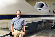
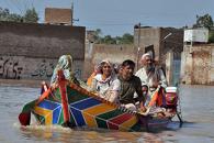

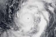
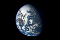
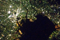
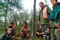
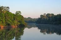
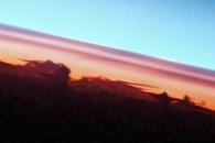

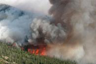
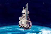

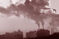


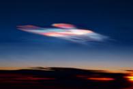
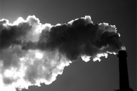
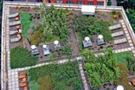

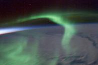
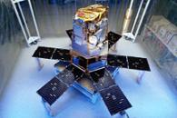
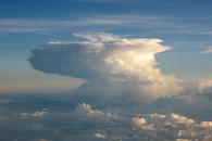
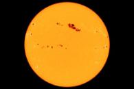

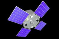
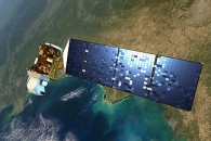
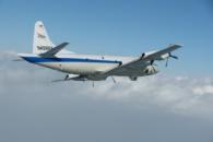
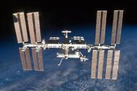
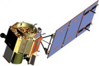
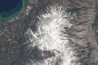
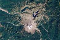

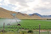
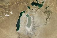

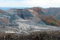
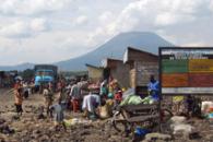
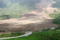
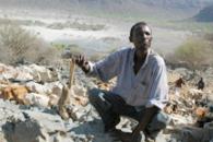
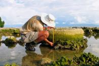
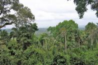
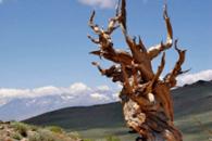
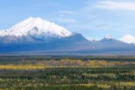
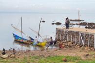
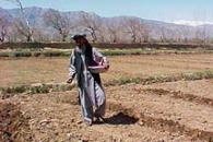
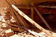
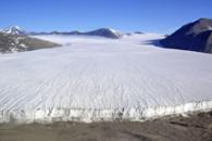
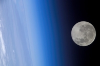
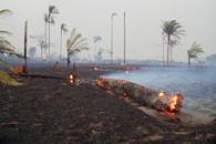
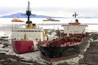
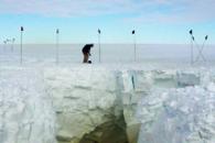
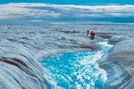
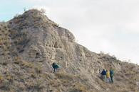
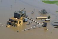
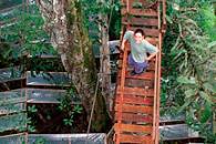
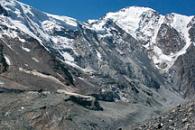
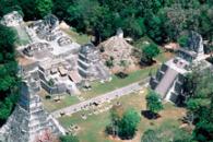
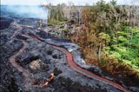
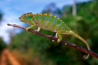
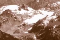
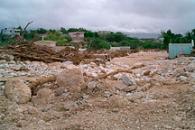
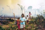
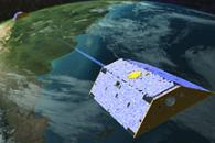
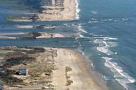
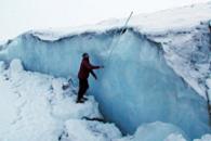
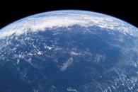
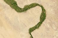
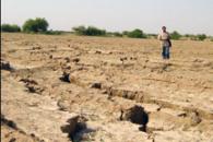
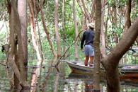
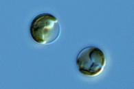
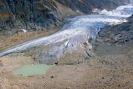
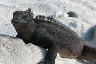

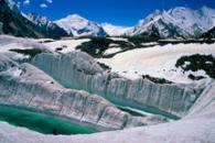

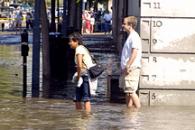
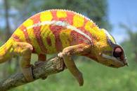
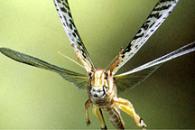
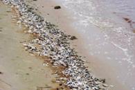


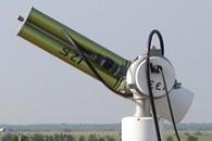

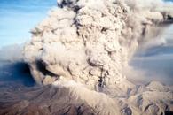
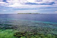

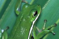
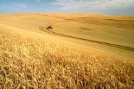

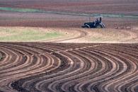
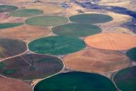

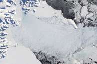
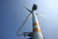
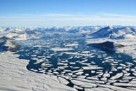
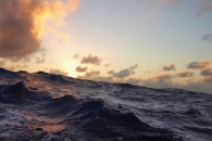
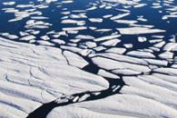
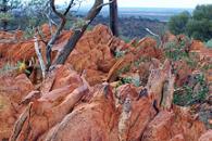
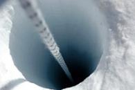
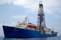
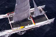
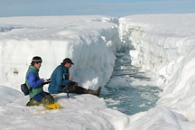
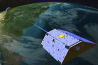
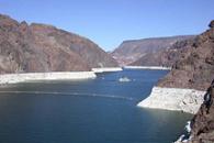

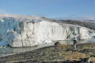
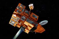

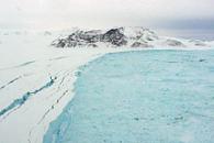
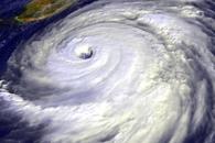

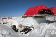
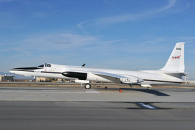
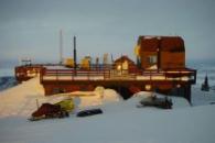
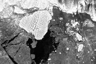

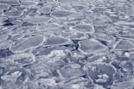
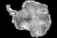
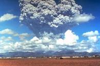
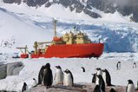
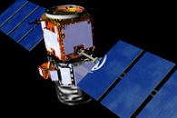
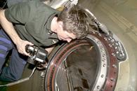
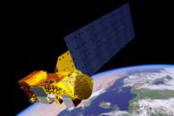
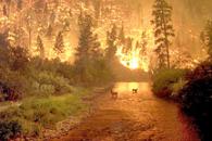


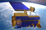
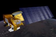

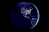
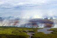
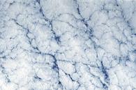

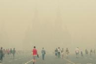
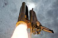
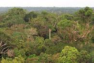
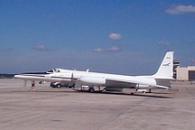
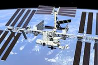
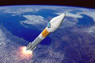
 Click on the image or the link below to send an email to MrC at